The goal of today was to get used to using the navigation tools that have been made specifically for the PCT. I had the Halfmile paper maps/app combo, plus the Guthook app. I had been studying them but thought it might be a good idea to take them for a test run on the PCT itself.
I had hiked a very small section of the PCT here previously while hiking to Bertha Peak. That hike involves coming up the Cougar Crest Trail, joining the PCT for a couple more minutes, then splitting off to the peak itself. I've even taken pictures next to the PCT symbol at the Cougar Crest Trail junction, back when hiking the trail had just been an idea.
I decided to start hiking at the highway 18 crossing, since it is labeled on the Halfmile map as the best place to hitchhike into town, and come down Cougar Crest, since I am familiar with the trail. It would be 11.1 miles on the trail, plus two or so miles down Cougar Crest. No problem, right? I should be doing those types of miles and more with a full pack on.
I was dropped off at highway 18 and started up a pebbly path with the PCT symbol. I was excited to be greeted right away by some beautiful, tiny, purple wildflowers. Hooray for wildflower season! I happily continued along the path to where it narrowed to what I had anticipated the PCT width to be from pictures. However, I was happy to see it widen again to a large gravel path. I continued along contently looking at the wildflowers and watching bunnies hop across the trail before I remembered the whole point of this hike was to practice using the maps/apps.
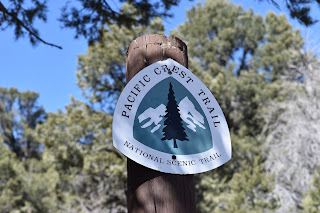 |
| Hello, PCT! |
I open up the Guthook app and pressed the location button. The trail coordinates are marked in red, but I was somewhere in the green colored section next to the red line. What? Already? I was clearly on a trail. Next I checked the Halfmile app. It said I was about 260 ft from the nearest trail point. I was pretty confused so I reopened the Guthook app and started backtracking. The little location button moved with me back in the way I came from and back towards a section of the trail that made a sharp right. I'm assuming that is where i went wrong.
As I was backtracking I noticed several gravel paths splitting off. Not sure of which path I actually came up on, I ended up take the forks that led in the direction of the trail on my Guthook map. It took me a couple minutes to realize these were 4WD paths, not necessarily hiking paths. Dammit. I got to a point where I was close enough to the trail location,and the terrain was flat and sparse enough that I could cut straight over to where the trail was supposed to be. Sure enough, after a short walk, I saw a narrow and defined path cutting through the forest. My lesson here was while hiking the PCT, look for the small path and regularly check your location. At least I know the navigation apps work.
 |
| The PCT is the small path coming from the left. This isn't confusing at all. |
Now that I was on the correct path, I followed it as it wound around the mountain to the side that faced the desert. It was a part of Big Bear I hadn't seen before. The times I had been here before I had only seen pine trees and mountain lakes. It is because of this that I practically lost my mind when I saw Joshua trees slightly down the mountain slope. Joshua trees! In Big Bear! What are they doing here? Those belong down in the desert below. I think I laughed out loud when I started seeing them on the trail itself. Come on, Joshua trees, I can see a snow topped mountain behind you. It is possible that I was so tickled by the idea of Joshua trees next to pine trees that I took pictures of every one I saw. It is possible…
 |
| A Joshua tree! |
 |
| Another Joshua tree! |
 |
| Look at all these Joshua trees! |
 |
| Joshua trees and snow! |
As I was rounding back to views of town, I past my first hikers for the day, a day hiking couple. As we exchanged the normal passing hiker greetings, I then heard, “Heading to Canada?” Well, kind of. Eventually… The couple was a ridiculously nice pair named Brian and Sheri. They too were considering hiking the PCT someday but, in the meantime, were doing mini section hikes in the area since they have a cabin in town. Still not over having just seen Joshua trees, I found a way to interject something along the lines of “Omigod, you guys, did you know there are Joshua trees here!?” into the conversation. Considering they had a cabin here, it probably wasn't a huge revelation. After a short chat we headed in our separate directions, me towards Gold Mountain, them towards all those Joshua trees.
I passed the dirt and paved road landmarks that were marked on my navigation apps, a couple birders, a trail camp, and a trail runner before heading up some switchbacks and then back to the other side of the mountain. The switchbacks crossed several times over what I can only describe as a rock “chute.” It was a mass of loose looking pinkish rocks and boulders streaked down the side of the mountain. Luckily it was very flat and steady where the trail crossed it.
 |
| Crossing the rock chute. |
As I wound around the back of gold mountain I encountered some snow patches on the trail. The patches themselves weren't very big and were easy to cross. After that, I wound back into the mountain to my favorite section of this hike. I went through a nicely spaced pine forest that was shaded, but still bright, and covered in pine needles. It smelled so good. There were a couple campsites in this stretch as well as a clear stream. It would make a wonderful area to camp and hang
out.
 |
| The beautiful pine forest section. |
 |
| Caribou Creek. |
Eventually I hit the north facing slopes again and the snow patches. On each snow patch I hit I noticed some large, man-sized boot prints indicating someone else had been here recently. After a couple patches I noticed some thing else. Paw prints. Clawless paw prints. That usually means they are cat prints. My mind immediately jumped to thinking they were mountain lion tracks, but it is also possible they were from someone's dog and I just couldn't see the claw marks. Whatever it was, me, the man, and the animal were all headed in the same direction.
 |
| Mystery tracks, but probably from someone's dog. |
The next time I checked my navigation apps, it showed that I was only a mile from my trail junction with Cougar Crest. Easy, right? Yeah, not so much. Those small snow patches suddenly turned into large snow patches. Luckily, I had packed my microspikes. I put them on and practiced walking in-balance, using my pole for any self-belaying that I might encounter. It was slow going, and it was probably safety overkill. But, I could always use the mountaineering practice and it never hurts to be extra safe.
 |
| Large stretch of snow. |
 |
| Microspikes on. Safety first. |
Eventually, I reached the junction with Cougar Crest Trail and bounded down it to where my ride was waiting. In addition to the other lessons I learned on this hike, I was reminded at how different hiking at elevation without acclimation can be. 13 miles shouldn't be too hard considering my recent hiking training. However, when I finished and sat down the exhaustion and swelling hit. Plus, I had a nice headache going. Reminder: elevation miles and non-elevation miles are not the same!
 |
| Big Bear Lake from the Cougar Crest Trail. |


Comments
Post a Comment