Posts

Showing posts with the label Pre-PCT Backpacking and Day Hiking Training Trips

Backpacking Training Trip: Sespe Hot Springs, Day 2, ~16 miles

Image
I woke up early this morning and hit the hot spring one more time with Ben before setting off again. Pan hadn't gotten up yet. I hung around longer than I had originally planned, but I eventually packed up everything and said "Goodbye" to Ben. I had Ben relay my "Goodbye" to Pan for me because I really needed to get going. Headed back along the Sespe River. Morning hike through the meadow. I made my way out of the hot springs, through the meadow, pausing to get my wildflower pictures. The water crossings took a little bit more work than yesterday since I no longer had my guides, but I was able to eventually find the cairns through the detritus that was created by the flash flood. Flash flood damage. River crossing. Cairns to help you find your way.  If you can find them through the downed trees. The scenery was still beautiful,  but the miles dragged a bit since I didn't have anyone to chat with besides the typical pleasantri...

Backpacking Training Trip: Sespe Hot Springs, Day 1, ~16 miles

Image
Today was the start of my last backpacking trip before I begin the PCT. I chose to hike to Sespe Hot Springs, located north of Ojai, for several reasons. First, as opposed to most of my training hikes, I had never been there before; second, there are a lot of water crossings for me to practice those skills; and third, there are hot springs. Hot springs! I got to the trailhead at about 8am. The Piedra Blanca parking area serves many trails, so it admittedly took two attempts to find the correct path from the parking area. I also realized why the area is named Piedra Blanca. There are some beautiful white rock formations. The aptly named Piedra Blanca. I headed down the trail that follows the Sespe River, crossing a couple of small tributaries. Most of these were close enough to the trailhead that there were logs and rocks to hop across. The trail then climbed the hillside next to the river, occasionally dipping back down to areas where people could camp. Sespe River Tra...

Day Hike Training: San Jacinto State Park, ~4 miles

Image
I took the Palm Springs Aerial Tramway up to Mt. San Jacinto today to practice my mountaineering/snow travel skills. Not only is it a fun novelty to take the rotating tram car, but it gets you up in elevation (and snow) quickly and easily. I brought my ice axe and hiking crampons with me. I already owned microspikes, but, additionally, I bought the Kahtoola K10 hiking crampons because I don't want to mess around with this year's snowpack in the Sierra-Nevada mountains. I can always replace the crampons with my microspikes along the way if I find that they are overkill. I also recently acquired snowshoes at an REI garage sale that I wanted to test out. I am excited to do some snowshoeing in future winters, and, in addition, they are a very unlikely backup in case I need them in the Sierra as well. When I got to the mountain station of the tramway, I could see the snow melt in full effect. There was patches of dirt exposed and the trail to the ranger station was fully expose...

Day Hike Training: PCT section near Big Bear: HWY 18 to Cougar Crest Trail, ~13 miles

Image
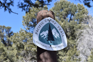
The goal of today was to get used to using the navigation tools that have been made specifically for the PCT. I had the Halfmile paper maps/app combo, plus the Guthook app. I had been studying them but thought it might be a good idea to take them for a test run on the PCT itself. I had hiked a very small section of the PCT here previously while hiking to Bertha Peak. That hike involves coming up the Cougar Crest Trail, joining the PCT for a couple more minutes, then splitting off to the peak itself. I've even taken pictures next to the PCT symbol at the Cougar Crest Trail junction, back when hiking the trail had just been an idea. I decided to start hiking at the highway 18 crossing, since it is labeled on the Halfmile map as the best place to hitchhike into town, and come down Cougar Crest, since I am familiar with the trail. It would be 11.1 miles on the trail, plus two or so miles down Cougar Crest. No problem, right? I should be doing those types of miles and more with...

Day Trip Training Hike: Bridge to Nowhere, ~10 miles

Image
This is another one of my favorite LA-area hikes. It is an approximately 10 mile round trip hike following the San Gabriel River to a beautiful 1930s bridge in the middle of the Angeles National Forest (or “Nowhere” I guess).  I think at one point there was supposed to be a road that was planned to go through the area but it never panned out. The fun thing about this hike, besides coming upon this structure deep in the wilderness is that it requires several river/creek crossings, which is why I chose to use this for training. The recent rains, combined with the snow melt, make for much higher crossings than I have ever done on this hike. I wanted to practice my water crossing skills and test out using my camp shoes (Crocs swiftwater waves) as water crossing shoes. I also got new, breathable hiking shoes for cheap at the REI garage sale that I wanted to test out on a hike, and also use on a couple water crossings to see how fast they dry out. Now, I'm not sure how many wate...