Day Hike Training Trip: Crystal Cove State Park, ~18 miles

Rather than going into the mountains or trying a new/challenging route, I opted to again hike in a place that is familiar to me. I used Crystal Cove State Park to train for my very first backpacking trip, the Trans Catalina Trail. The Crystal Cove backcountry trails are fairly exposed and can get pretty hot, but I know them like the back of my hand. I also have avoided hiking in “heat” lately, so I wanted to see if my new shirt actually kept me cool while still providing protection from the sun.
I like to start my hike at the top of the backcountry, so I have the challenge of finishing my hike uphill. Technically the trail I start on, Bommer Ridge Trail, is part of the Laguna Coast Wilderness and has connecting trails leading to the state park itself. I only hiked with my day pack (again) and ended up starting later in the day than I wanted to, hitting the trail head at about 9 am (again).
On a clear day the views from Bommer Ridge are awesome. It wasn't the clearest day we have had recently, but I could still see the snow-capped Mt. Baldy to the east and, at the same time, Santa Catalina Island to the west. The area has also gotten a lot of rain, so it was an incredible green color, instead of its usual dull brown.
 |
| Mt Baldy to the east. |
 |
| Santa Catalina Island to the west. |
I took Bommer Ridge to Morro Ridge and headed down into Crystal Cove State Park. As I started heading downhill, the view of Catalina became much more awesome and eventually I got a bit of an ocean breeze. I almost didn't get up for this hike this morning, considering that when I woke up my legs felt very sore from yesterday's hike. However, when I started walking them out the soreness went away and they started to feel great.
I then took BFI (trail) down to my lowest elevation, and started heading gradually back uphill on the Morro Canyon trail. When I got to the trail junction that gave me options for returning uphill, I took the Poles route. Poles is the shortest trail up, but it is also the steepest. To my surprise, Poles had a corridor of vegetation. There looked to be hedge-size mustard plant where there are usually dirt mounds. In a couple weeks those “hedges” are probably going to be covered in yellow flowers. I may have to hike this again soon.
 |
| The bottom of Poles. There usually isn't much vegetation here. In a couple weeks this will probably be lined with yellow flowers. |
At the top of Poles I connected with No Name Ridge which took me back to my starting point. It is a bit of a rough way to end the hike, considering there are still there steep hills to climb. And it was midday, so it was pretty hot. Luckily my shirt was doing a pretty good job of keeping me from overheating. I also saw a roadrunner as I got closer to the subdivisions! Roadrunners are such funny birds and I love having encounters with them. The roadrunner, on the other hand, didn't seem to appreciate the ensuing photo shoot I did with it.
 |
| Roadrunner! |
The hardest part of the hike was when I got back to the starting point. The goal was to do the same loop twice, so I get myself used to walking longer distances. But, it was so hot. And, my car was right there. And, I suddenly thought of a huge list of things I needed to do that were more important than doing the second loop. Begrudgingly, I kept on hiking.
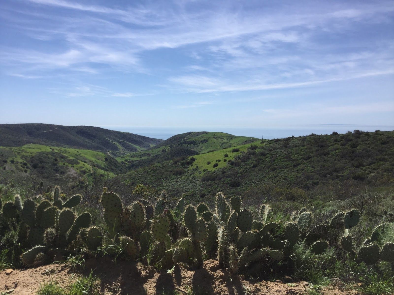 |
| Views from near the top of the ridge. It is almost never green like this, but the area has had a lot of rain lately. |
My second loop around the park started to drag a bit, since the scenery hadn't really changed since the first time I went around. I stopped briefly at the Upper Morro Campground to eat lunch and more of the wildflowers that are just starting to bloom had opened up, but otherwise it was an uneventful second loop. At least it got cooler as I went back uphill the second time. I decided to take the West Cut Across (trail) back up to No Name Ridge since I was getting tired and didn't want to have to deal with Poles again. I ended up getting back to my car at about 5 pm, just in time to sit in rush hour traffic. Awesome.


Comments
Post a Comment