FT2018 Day 22: Joshua Creek Campsite (mile 346.1) to Old River Road (mile 361.8)
15.3 FT miles
It rained last night. I didn't have cell signal, but the last time I checked, it was supposed to rain in the early morning as well. I wasn’t planning to do very many miles today, so I had the luxury of packing up my tent whenever I felt like the rain had stopped.
When I did get moving, it was incredibly damp. Everything around me from the trees, to the ground, and even my shirt was damp. It must have been 100% humidity. While it was annoying at the moment, I knew it was going to be real uncomfortable later on when the temperatures approached 80 degrees (F).
I headed through another series of WMAs/Wilderness areas. I keep going through them quickly, so most of the time I'm not sure which one I am in anymore.
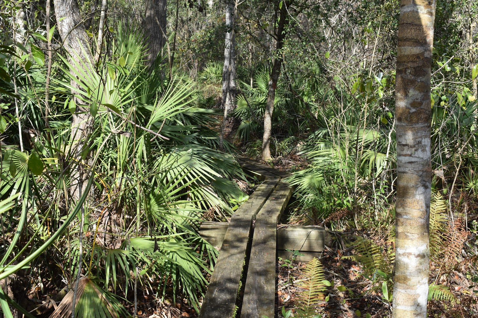
 |
| The soggy, morning trail. |
I walked through the standard forest areas until I got to a bog. Trail crews had made a nice boardwalk through the bog which protected both the bog and my shoes. It was a little slippery, so I made my way across slowly. There were lots of ferns. I was hoping to see the carnivorous pitcher plants that are also found in Florida bogs, but didn't see any.
 |
| The bog boardwalk. |
In between bogs, I got a treat by walking through an area covered in lichens. The app pointed out another plant in the area, the rosemary scrub, but I thought the lichens were much more interesting. They were spongy green tufts that covered the ground like snow.
 |
| Lichens. |
I kept seeing armadillos both last night and today. They are everywhere. Crunching around my campsite at night and surprising me in the middle of the trail. They are super weird looking animals.
 |
| The noble armadillo. |
Soon after, I left my current wooded area for my next wooded area. Of course, this was connected by a road walk. This was an unusual road walk though. Instead of going down highways or country roads, the trail lead down a quiet residential street that seemed to be upscale horse properties. I had to remind myself that I wasn't out in the country anymore, but on the edge of the Orlando-metro area.
 |
| A quite road. |
I headed into the next wooded section, and waited until I was out of view from the structures to sit down for a quiet lunch. While I was eating, the sun came out. I had cell signal and checked the weather again. Originally, I was supposed to be hit by thunderstorms in the afternoon. It looks like between yesterday and today, that forecast changed. I wasn’t complaining.
 |
| More boardwalks. |
 |
| Ferns. |
Vlog 1
Soon after lunch, I came to a spot that had a small sign that said “FNST reroute.” There was no other information, just an ambiguous arrow. I checked the comment section of the app and there was a note from an earlier hiker. It said that there was a set of bridges that were closed up ahead and that he had no problem crossing them. I saw a similar post on Facebook, so I continued down the trail for which I actually had information.
Soon the Florida Trail connected with the Flagler Trail, which at first appeared to be a road. I usually associate “Flagler" with Henry Flagler of Flagler's Folly, which was the attempt to build a railroad to Key West. So, when I looked closer, it was obvious that this trail had once been a railroad as well. When I got to the Econ River, there were more signs of a railroad. There were pilings that looked like they used to hold a bridge.
 |
| The Flagler Trail |
The Econ River’s current bridges posed a problem for me. These bridges were the one the other thru-hiker had noted were closed, but on which he was able to cross safely with some locals. He said that the river was fordable as well if the bridges seemed unsafe.
I examined the bridge. I'm not a structural engineer, but they didn't seem too bad. The handrails were cracked a bit, but the structure underneath didn't have any apparent damage and the boards on top didn't look cracked or worn. I've definitely crossed sketchier “open” bridges on the trail.
I crossed the bridge, ready to grab onto the side should something break. Nothing even creaked. I made a similar assessment of the second bridge and crossed it without issue. When I looked back at the closure page on the official Florida Trail website, I was back where the reroute rejoined the trail.
 |
| The Econ River and one of the closed bridges. |
Just as I was thinking that I have crossed sketchier bridges, I came to a sketchier bridge. This one definitely should have been closed. But, because I didn't have an indication that it wasn't, I started to cross. I regretted it.
The bridge was leaning slightly, but by the time I noticed that, I was already committed. At the other end were some loose, cracked boards. I picked the sturdiest path I could across and sighed with relief when I hit dirt again. I looked at the bridge, and the drop down. It was pretty high. I left a comment in the Florida Trail app to warn people.
I continued down the trail without more bridge issues, despite thinking that the “closed" bridges were sturdier than all the other bridges I had crossed. The trail itself was gorgeous. It was a sandy bluff through the trees, following the winding Econ River. It was really nice scenery.
 |
| The Econ River. |
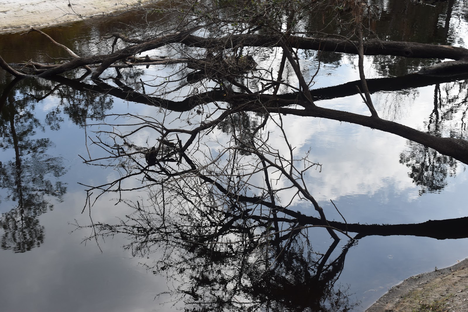 |
| Reflections in the Econ River. |
 |
| Looking back at a broken bridge. This was not one of the bridges I crossed. |
 |
| The Econ River again. |
 |
| The "crossed palms" landmark on the trail. |
 |
| Sun, moss, and a blaze. |
 |
| The trail on the bluff. |
 |
| Someone forgot to pay the troll at the Penny Troll Bridge. At least this one was easy to walk around. |
I followed the trail until I hit Old River Rd., which was the last place to camp before I go through a long stretch of the northeast Orlando-metro. The grassy area where I was going to camp had a short path down to the river beach.
Since it was a short hiking day, I went down and hung out at the beach, watching the late day reflections on the water. It filtered some water for myself and as I was heading back to my pack, I made the mistake of cutting across a muddy section instead of the sand. Slip! Now one side of my pants had some muddy streaks. Oh well, tomorrow I'm doing laundry anyway.
 |
| The beach near my campsite. Vlog 2 |


Comments
Post a Comment