FT2018 Day 52: Hillcrest Baptist Church (mile 895.4) to campsite near powerlines (mile 936.5)
41.1 FT miles
Ugh. This was a day.
The realization about just what I had to do to make it to Ebro in time to pick up my package was stressful, so I didn't exactly go to sleep soundly. So, when I frighteningly close coyote called to its pack just before 1 am, I woke up.
After a quick Google search about what to do if you meet an aggressive coyote, I packed up my belongings and left the church. I was originally going to give myself an hour or two more to sleep, but I was up anyway and had a long way to go. I basically had a day and a half to go about 50 miles. That is pretty daunting.
Walking 274 at night was actually a pleasant experience, especially when compared to the day. During the day I had the sun, the humidity, the heat radiating off the asphalt, and all those cars whizzing by. At night, it was cool. Cars only came by occasionally and most of the time I had the pavement all to myself. It was just me and the stars, and there were a lot of stars. I was far enough out in the country that you could see all the little stars, not just the big ones in the constellations.
There were some concerning parts too. I was walking in cool, light fog, but every once in a while I would get a hot breeze that smelled like campfire. This reminded me of walking through the wildfire areas of the PCT. My recent experience has also made me wary of the prescribed burns and how well the area being burned has been closed. I was thankful to be on a main, paved road and not a forest road or trail.
The other issue was when I passed by residences. Everyone on Florida seems to own a dog. These dogs all seem to have protective/territorial behavior. So, anytime I passed a house with a dog it would charge and bark/growl. It is a good thing that Floridians in this area also have fenced in property.
Towards the end of my roadwalk I got pretty tired. I dragged myself to the trailhead of the Econfina WMA and set up my tent right next to the trail sign. I it was around 4:30/5 am and I was only going to sleep around 3 hours anyway.
 |
| Entering Econfina at night. |
Around 7:30/8 am I got up and packed my tent. It was a later time than I usually get up in the morning, but I also usually don't go to sleep so late.
I started walking into Econfina WMA. It was already hot and humid out, but the shade of the trees made it much more pleasant. I just imagined walking the roads in this weather and I was glad that I knocked it out last night instead.
 |
| Econfina trailhead in the morning. |
I started to cross a series of boardwalks and bridges. They all were not only intact but covered in sandpaper to add traction. What luxury! I also crossed a couple of streams that were crystal clear. I started to get hopeful that Econfina Creek itself was crystal clear too, so I was a little disappointed when I saw that it was another tannic waterway.
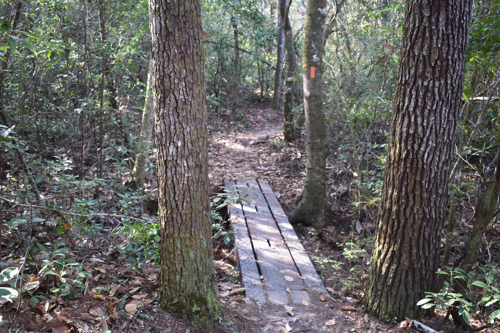 |
| An intact bridge with traction. I didn't know there was such a thing. |
 |
| A nice suspension bridge. |
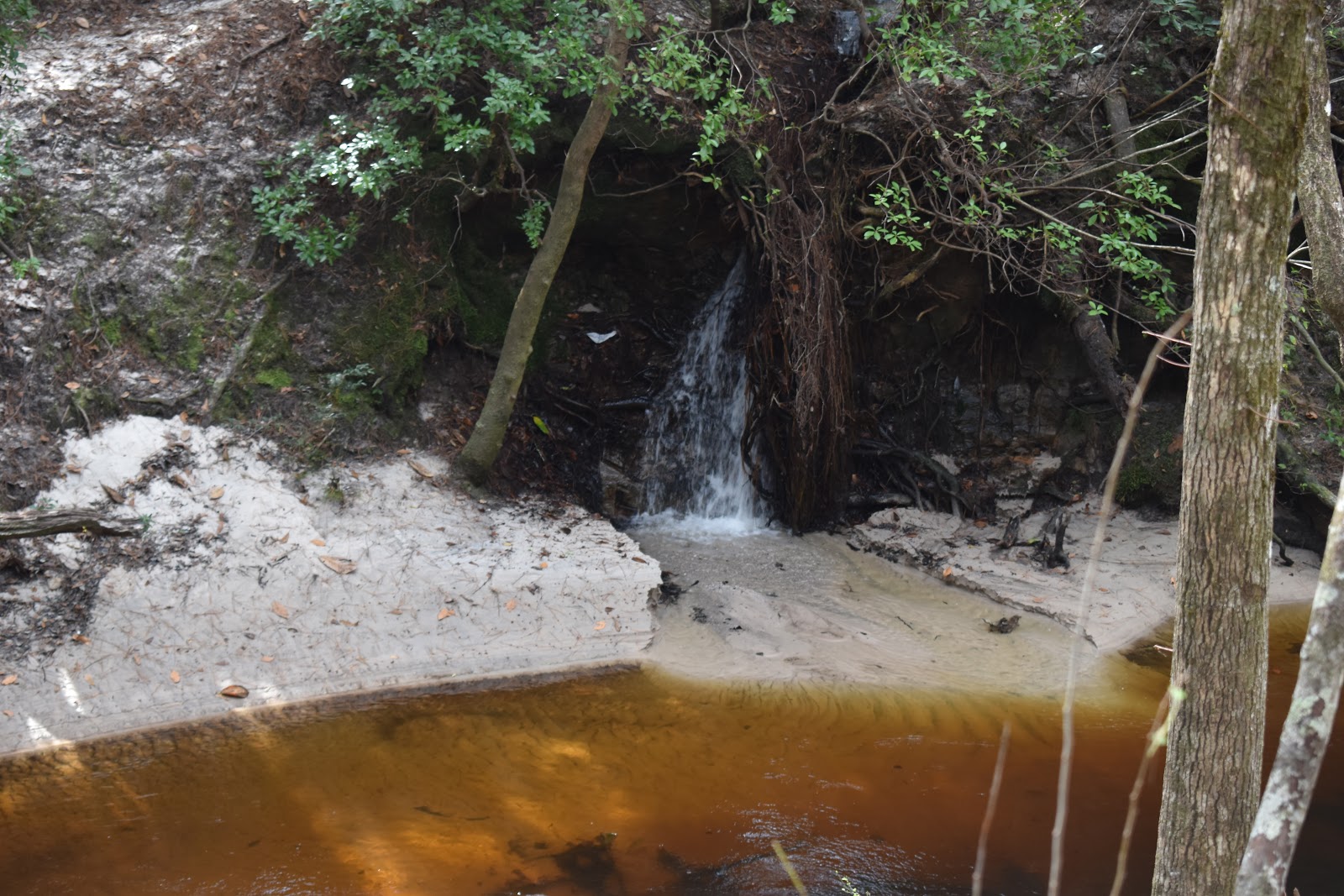 |
| A clear mini waterfall flowing into Econfina Creek. |
 |
| Econfina Creek. |
Vlog 1
It was still a pretty creek and the trail wound up and down its banks that were made up if powdery white sand that squeaked underfoot. It was enjoyable, but the heat, humidity, lack of sleep, and effort to climb/descend started to wear me out. I was very grateful to find a flat spot suitable for lunch. I needed energy and I didn't realize how thirsty I was. I drank all my remaining water supply. A couple tenths of a mile further, I filtered another liter and a half of water.
 |
| The white sand trail. |
 |
| Sandy bluff and the creek. |
Over the next few hours, I walked the banks of Econfina Creek, going through the woods, and over the tributaries. Sometimes there would be a boardwalk/bridge, other times I would need to go down the bank and hop it. There were even a couple suspension bridges.
Eventually, I got to a sinkhole area and the trail became a little more wooded. I passed a trail crew and did a quick greeting instead of a chat, since I had so much walking to do. I headed through pine forest and eventually made it to a lakeside camping area called Rattlesnake Pond.
 |
| Orange blaze and yellow flowers. |
 |
| The view at Rattlesnake Pond Campground. |
If I didn't have a post office to make it to, I may have camped here. It was a series a campsites with privies and a covered pavilion. It was all situated next to a clear lake. Instead, I took a short break, used the privy, and filtered water.
 |
| Filtering clear water. |
I kept walking through the pines until I came to a section of the trail where the trees were being clear cut. Clear cutting means tearing down every tree in a plot of land, and is pretty disruptive/destructive. When I got to that section, you couldn't even tell where the trail used to be. It didn't matter though because we were funneled down some logging roads as a detour to SR 20, our next super long road walk.
 |
| A clear cut plot. |
 |
| Sunset. |
Vlog 2
My plan was to set up my tent near SR 20, sleep a couple hours, then tackle the road walk at night again. It looked like a lot of the plots near the highway had been clear cut and replanted, so I set my tent up in the last area that had adult pine trees. I could hear the rush of cars on SR 20 and hoped that traffic would die down in a couple hours.
I set my alarm for 3 hours, but I think I only fully slept one of those hours. I reluctantly got up, packed the tent and headed to SR 20. Traffic had gone down a huge amount since I had gone to sleep. Whereas there had been a constant stream before, there was now only an occasional car.
Just like the night before, a lot of the time it was just me, the stars, and the pavement. It felt slow going, but the temperature was cooler and I didn't have any warm, campfire-smelling pockets. I reached a gas station that was unfortunately closed, took a break, then kept going.
I zoned out in my music and my audio books for a couple hours, getting out of the way of the occasional car or truck. After a while the back of my legs and calves were fairly painful. I could feel the swelling not only in my feet but in my ankles too. I took an anti inflammatory, which helped a little but not fully.
I gritted out another few miles and traffic started to pick up as early birds started to head towards work. My muscles have been tired before, but rarely have the ever felt like they did those last few miles. As I stepped, they stopped feeling like they would spring back after stretching. Like they would not work properly. It didn't quite come to the sensation of the muscles fully collapsing under me, but I started to worry about it.
I staggered the last mile to the point where the trail turns away from SR 20 and towards Pine Log State Forest. I originally was going to try to get to the state forest boundary, but now I was just looking for anywhere to pitch my tent. The app suggested there would be some flat spots to pitch a tent where powerlines cross the trail. I got to that spot and set up my tent in the first flat area I could find. It was almost on the trail itself, but I didn't care at that point. I would be leaving again soon anyway.


Comments
Post a Comment