Posts

Showing posts from February, 2018

FT2018 Day 50: Camel Lake Campground (mile 858.5) to Bristol (mile 873.9)

Image
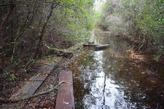
15.4 FT miles Yesterday took more out of me, both physically and emotionally, than I had imagined. After I had taken my shower, I couldn't really stay awake. I must have fallen asleep before 7 pm. As a result, I woke up just before 1 am. I was on edge because of the awful time I had yesterday and could not go back to sleep despite my best efforts. Even though I wasn't asleep, I still got up later than I originally planned. Go figure. I packed up everything, filled up with water, and headed down the road to CR 12. I was taking the forest road and not the trail to CR 12 because the camp hosts had warned that the trail north of the campground was very flooded. I already had enough of an adventure yesterday. I was in an incredibly bad mood. I had a lack of sleep and I was still angry about being evacuated and having to cut short my continuous steps so close to the end of the trail. I had people suggest that I could go back and pick it up. However, I would have to wait at

FT2018 Day 49: Campsite (mile 835.6) to Camel Lake Campground (mile 858.5)

Image
22.9 FT miles, minus about 3 miles for evacuation It was another grey morning. There was still fog, though not as much as there had been the past couple mornings. I picked up where I left off, moving through the pine forest. Soon after my campsite, the vegetation became dense and overgrown. I'm not exaggerating when I say I could have used a machete. Soon after hitting that first wave of bushwhacking, I got to do my first wade of the day. It was my first of many. I was moving in and out of a lot of swampy areas. Some of them had boardwalks. Some of those boardwalks were even functional. However, none of them were long enough and I ended up wading through the water anyway. A slightly scattered boardwalk. Uh... Vlog 1 The day definitely had a pattern to it. I would be on a forest road,  then the trail would turn into the pine forest. Almost always after this, the trail would dip in and out of vegetation that contained some form of swamp. It was like the tr

FT2018 Day 48: Bradwell Bay South Trailhead (mile 817.9) to campsite (mile 835.6)

Image
17.7 FT miles I waited for it to get light out, then packed up my tent. I was enveloped in a thick fog again and my tent fly was soaked. Luckily the fly took the worst hit from the moisture as everything inside my tent was still dry. Another foggy morrning. I wore my water leggings as I headed out in trail. I would be hitting the worst of Bradwell Bay today and I brought them for swamp hiking since they were made for water and offered less drag than my hiking pants. The trail was dry at first, but soon I started splashing through ankle deep water. Then, I transitioned to a forest area. If this was the swamp, it was much different than I imagined. I thought I would be wading through deep, dark water with the occasional cypress poking out of the fog. It was more like walking through a flooded forest. There were tangled of trees to navigate through with logs, roots, and mosses everywhere. It was honestly pretty cool and different. The water wasn't too deep either. T

FT2018 Day 47: Bent Sapling Camp (mile 799.2) to Bradwell Bay South Trailhead (mile 817.9)

Image
18.7 FT miles It was another foggy morning. I started off walking through a pine forest again, but it was grey and misty because of the weather. I tried to walk through it as fast as I could. I had been too concerned yesterday about making the border with the national forest, that I didn't look at what was in this upcoming forest. Morning on the trail . At least it is cool looking fog. The sun trying to break through the fog. I was going to hit Bradwell Bay, which is the second official swamp area the trail goes through. It is much smaller than Big Cypress but whereas Big Cypress was a clearwater swamp, Bradwell Bay is a blackwater swamp. I had also been warned by Mostly Harmless to not go through at the end of the day and I saw that the deepest part started about 18 miles from where I had camped last night. Oops. I didn't think I could get through the whole swamp today, but Good Man Gramps did quite a bit of note taking and suggested where to camp alo

FT2018 Day 46: Shell Island Fish Camp (mile 770.4) to Bent Sapling Camp (mile 799.2)

Image
28.8 FT miles, but probably less because of detours Despite taking a half day in St. Marks and staying in a hotel, I did not get much sleep. I took a little too long to start on my blog and vlog uploads, and the internet was very slow. It took a long time to upload even a single picture. I worked until around midnight last night, then got up at 5 am to finish what I could. I had originally planned to start in the dark this morning, but ended up leaving in the early light. I had to cross the border from St. Marks National Wildlife Refuge to Apalachicola National Forest because of camping permit requirements in the NWR. The border was approximately 27 miles away. I left the fish camp and walked the residential roads until I came to the trail. In this section it followed the bike path that was built on an old railroad bed. It was a nice bike path with regular benches, trash cans and privies. There was dense fog again this morning which provided an eerie feeling. Morning on