Posts

Showing posts from September, 2017

Trail Day 120: Tentsite (mile 2421.9) to tentsite (mile 2446.4)

Image
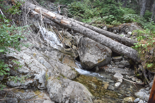
24.5 PCT miles The day started early with what seemed like an endless, steep downhill. I was trying to go at a fairly quick pace as today was supposed to be the day the rain and cold front came through. I haven't had cell reception in a while, but if the forecast still held true, the rain would start later in the day. In a way I was glad for the rain. It would help with the forest fire issues. There still was not much of a view today because of the smoke from the Jolly Mountain Fire and the air still smelled faintly of campfire. I also had to worry about the Diamond Peak Fire north of Stehekin. If that grew any larger it would close the trail in between the last resupply town and Canada. The last road that the PCT crosses has already been shut down to traffic. When I finally reached the end of the downhill section, and the Wampus River, I ate breakfast and took a break. After that I crossed a series of rivers and creeks. Most of them had at least little waterfalls and cle

Trail Day 119: Ridge Lake (mile 2397.8) to tentsite (mile 2421.9)

Image
24.1 PCT miles I woke to the faint smell of “campfire.” I knew what that meant even before I left my tent.  My view was gone. Sure enough, after I packed up and headed out on trail, I was walking through smoke, just as I had in Oregon. Smoky sunrise.  Within 2 miles I came upon the 2,400 mile marker. This is the first of the 100 mile markers I have passed by that has actually been on trail in a while. Should there be no more closures, it is 259 miles to the border. Mile 2,400. I continued down the trail which was all uphill at this point. A lot of it was over jagged, loose rock, so it was slow going. When I got to a wider area, I stopped at one of the campsites for breakfast. As I had been hiking uphill, I had warmed up and removed a couple of l layers. When I ate breakfast I started to chill again. After I had finished, I reached in my pants pocket for my gloves.  I only pulled out one. Crap. Should I backtrack and look for it? I thought about it for a

Trail Day 118: Snoqualmie Pass (mile 2390.6) via Packwood to Ridge Lake (mile 2397.8)

Image
7.2 PCT miles Despite being told how cold it would be at night, it wasn't as cold at Momma G’s as it had been the previous nights of camping. My gear has been pretty good at keeping me warm too, so when I woke up I was nice and snug. I packed up my bag and headed inside where we were made breakfast. Lynn then took a set of hikers to White Pass. There was another set that Momma G was going to shuttle into town while I,  and a couple other hikers, were going to be shuttled to Snoqualmie Pass. We waited for the trail angel, Scott, who would drive us to Snoqualmie and then all went our separate ways. I had to temporarily say goodbye to Zorro and Little Engine, who were headed into town for a zero day. I had two other hikers I hadn't met before, Lego and Slim Shady, join me for my shuttle. It ended up being a 2-3 hour drive due to the closures and construction that was going on. I swapped stories with the other hikers during the drive. We were dropped off at the Summ

Trail Day 117: Cispus River (mile 2269.9) to White Pass (mile 2292.4)

Image
22.3 PCT miles I was going to do a really short day today. The goal was to get to a campsite a couple miles out of White Pass, then hitch into Packwood the next morning and figure out a plan from there. I still got up and started moving at first light, since I knew the terrain would be difficult, and you never know what the PCT will throw at you. The wind had come in last night, rattling my tent so that I didn't get a lot of sleep. It also brought in the clouds and a little bit of smoke so the views weren't as clear. The terrain was cool. It was much more dramatic and rocky than I have seen for quite some time and reminded me a little of the Sierra. I was starting the day with a couple miles of steep uphill to a section known as Knifes Edge. Early on in today's hike,  looking back at Mt. Adams. The PCT.  That sounded like it would be a challenge and was one of the reasons I got up early. There was even a “stock alternate” route to make it safer f