Posts

Showing posts from April, 2017

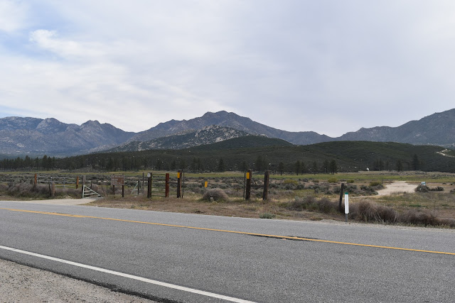
Trail Day 13: Tentsite (mile 182.7) to tentsite (197.2)

Image
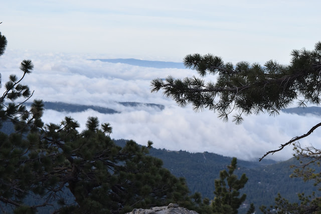
14.8 PCT miles Last night the wind was so loud. I had managed to put my tent in a spot that was pretty sheltered from the wind, but every once in a while there would be a huge gust that would break through the trees I was using as a wind block and rock my world (my warm, enclosed tent space). Needless to say I did not get a good nights sleep. I also didn't want to break down my tent in the cold wind when I woke up, so I laid in my warm sleeping bag for a while. Eventually I had to get up, since the goal of today was to get through the snow (starting two miles from camp and continuing on for 5 miles) while it was still firm and solid.  Of course, after I had packed up and walked a quarter of a mile down the trail, the wind all but disappeared. I'm starting to think that the wind has somehow acquired a twisted sense of humor and enjoys messing with me. Remnant clouds over Idyllwild. As I did the backtrack of shame, first downhill, then uphill, I bumped into two oth

Trail Day 12: Tahquitz Peak Trail Junction (mile 178.0) to tentsite (mile 182.7)

Image
4.7 PCT miles plus, 2.5 mile side trail and 6 miles of backtracking Today was supposed to be the day I cleared the Mt San Jacinto area, including the steep and snowy Fuller Ridge. I wanted to pick up right where the fire closure ended, but the Tahquitz Peak trail from Idyllwild was still iced over and very treacherous, requiring expert skill with an ice axe and crampons to get through.  After talking to the rangers in Idyllwild yesterday I decided to take a different trail, the Devils Slide trail to meet up with the PCT. Devils Slide intersects with the trail about 1.4 miles down the PCT from where the fire closure technically ends. From talking to the instructors in the mountaineering classes I recently took, the real keys to mountaineering are not necessarily the snow travel skills themselves. It is the preparation, risk assessment, and ability to "turn around" if necessary. From my perspective I was practicing good mountaineering. There was no need for the ext

Trail Day 11: Remainder of Mountain Fire Detour to Idyllwild

Image
~11 miles of detour Originally I was going to skip part of the Mountain Fire Detour.  I had taken the PCT to the point where it had closed, then come down the mountain.  I figured if I picked it up on the other side of the closure, I would have walked all of the PCT that was available to walk.  The detour around the closure was mostly on roads anyway. That didn't count. At least that is what I thought as I laid pathetically against the pipe gate at the junction of Fobes Ranch Rd and highway 74.  A few days of rest, along with the stupid voices in my head convinced me otherwise.  The imaginary PCT "cool kids" in my head were scolding me for not walking the whole thing.  After all, the detour was part of the PCT route until the trail could reopen. Additionally, after resting a couple day, walking the remainder of the detour didn't seem like such a bad idea. This is where I left off a couple days ago, a sad sack of swollen limbs. I had my Trail Angel drop me

Double Zero

My last couple days on the trail were pretty tough on my body for some reason.  Maybe it is because all my training trips were only a couple days long.  Even though I did quite a few miles on those trips, I have never hiked for this long before.  My legs, ankles, and feet were all painfully swollen. On the first day of my double zero I went to the gym to swim/use the hot tub, and rested.  By the end of that day I only had some swelling remaining in my feet.  On my second zero day I ended up doing some walking. I attended the March for Science in downtown Los Angeles.  As someone with a B.Sc. and M.Sc. in Biology, I would have felt guilty missing it.  It was kind of bizarre that there was a need for an event to defend the importance, integrity, and neutrality of science to begin with.  I have never been to a protest or march before, so it was definitely a new experience for me.  There were some anti-Trump protesters with matching signs infiltrating the group, trying to drown out the p

Trail Day 10: Tentsite (mile 154.5) to Fobes Ranch Junction (mile 166.6), plus detour to highway 74

Image
12.1 PCT miles, plus 5.4 miles of detour I woke up this morning and tried to come up with a plan. Today I was going to hit the point where the PCT is closed because of fire damage, which was a little over 12 miles away. The detour route was mainly a road walk and didn't have very many places to camp since it wasn't designed to be part of the PCT. One option was that I could do a short day, camping as close to the closure as possible, then do the entire detour the next day. The other was that I could walk to the nearest campground at Lake Hemet, which I estimated to be about 18-something miles away, then do a short day into Idyllwild after that. I was leaning towards the second option, but camping at Lake Hemet was fairly expensive (for PCT camping). I would also be waiting in Idyllwild for my Trail Angel to pick me up for a long time, since I planned to zero at home again. From the last couple days of hiking, I could tell that my body needed to rest. This secon