27.9 PCT miles
Seeing as I didn't go as far as I had wanted to yesterday, I got up really early (5 am) this morning to try and make up some miles. I had camped with a huge group last night, so there were tents everywhere. I tried to pack up quietly, doing my best not to disturb anyone.
After I had gotten everything packed, I tried to find where the trail resumed. I saw a trail, tiptoed around the tents, trying not to shine my light at them, and headed downhill. I deadend-ed at one of those toilets that trail crews on Washington had constructed. I accidentally took the toilet path instead of the PCT. Since I was there anyway, I decided to use the facilities.
 |
| These pics are from another day, but one of the side trails leading to what someone referred to as a "nature toilet." |
 |
| This might look weird, but they were tucked way off trail and a luxurious alternative to digging a cat hole. |
I got back up to the campsite and walked to where I thought the trail might be. I ended up walking back to where I had pitched my tent instead. Finally, I spotted the trail. I hadn't seen it because Holiday was cowboy camping directly on it. I tried to scoot around him, but my headlamp woke him up for the second time on the trail.
Holiday might be my favorite person to accidentally wake. Both times it has occurred, he has reacted by trying to have a conversation like he has been wide awake the whole time, although he is mostly asleep. This morning he greeted me with a friendly “Hey!,” like I was a friend he hadn't seen for a long time, followed by “It's really coming down out there, huh?” In reality, there was a light mist.
I left Holiday to fall back asleep and went down the switchbacks towards the campsite I was hoping to get to yesterday. I got there to find Vortex, Flame, Hey Girl, and Papa Oats just packing up their tents. I hadn't lost any ground on them.
I ate a quick breakfast and headed further downhill. The rest of the group caught me as I reached a trail junction. It was to a PCT alternate. Actually, the alternate was the old PCT route until the bridge washed away. The trail was rerouted to the current bridge, but was 5 miles longer. The others chose to do the alternate, which wasn’t a maintained trail, but I have come to appreciate a well maintained trail and did the official route.
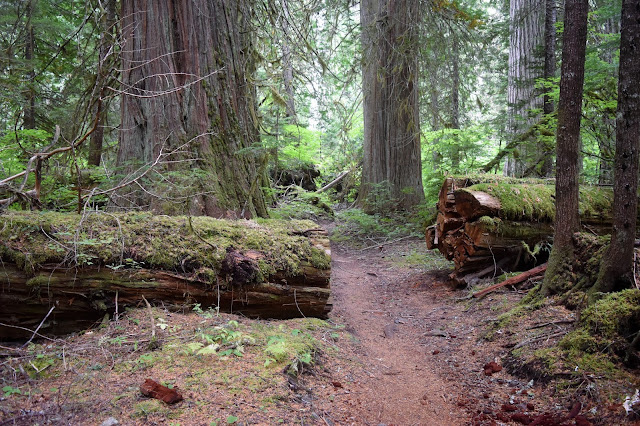
I was walking through a sea of green with mosses covering everything. The terrain was pretty level and the trail was well maintained, as was the nice bridge. It took a long time though. Based on the lack of people passing me, I assumed that most of the other hikers took the shorter alternate.
 |
| Walking the PCT. |
 |
| Moss covered everything. |
 |
| More little cascade water sources. |
 |
| The bridge crossing Suiattle River. |
 |
| The Suiattle River. |
I stopped near Miners Creek for a quick lunch, then started the long slog uphill which took most of the day. It was 7.5 miles of uphill.
 |
| More moss covered terrain. |
 |
| Water source. |
 |
| The "log bridge" across Miners Creek. |
 |
| Heading up. |
 |
| Another water source. |
Eventually, I reached the edge of the cloud cover, which had been low all day. It created a mist-rain that made me put on my rain gear. Otherwise, everything would get soggy.
 |
| In the cloud layer. |
After what felt like an eternity, I crested the hill and headed downhill as quickly as possible to get out of the cloud layer. It was still misting a little, even when I got below it.
 |
| Just below the cloud layer. |
 |
| View from the trail. |
I made my way downhill, trying to get to the campsite I had in mind before I lost the daylight. I crossed the creek that was 0.2 miles away and ended up getting my socks and shoes wet. I saw a campsite right next to the creek and figured that it was good enough for the day.


Comments
Post a Comment