AZT 2019 Day 28: Pine Trailhead (mile 461.1) to campsite near the East Verde River (mile 479.7)
18.6 miles
My parents and I left Mesa in the early morning today and were able to get to Pine by about 8:30 AM. We weren't, however, able to get a parking space at the trailhead. There was a lady angrily waving us around as we tried to pull in. We had to make our own parking spot along the entry drive.
I said goodbye to my parents and headed towards the trailhead. There were tents, music, and people wearing numbers. I entered the trailhead, half expecting someone to stop me. There was a sign that said today was the Pine Trail Race, and it looked like this trailhead was the finish line.
 |
| The Pine Trailhead. |
Sure enough, a couple feet in I had to step aside for a trail runner. A minute or so down the trail, I stepped aside for another. Eventually, I ran into someone from the event and asked him how much the race route shared with the Arizona Trail. We compared maps and saw that the trail and route diverged not too far ahead.
A little further up trail I hit the race pack. I was definitely swimming upstream. I could only take a couple steps before stepping aside for several runners. They were all very nice though, and greeted me with a hello. One even apologized for causing me to step off the trail.
Finally, I hit a non race portion of the trail and started gaining in elevation. The views were amazing. I could see the surrounding hills and mountains, as well as the town of Pine and highway 87.
 |
| Heading up in elevation. |
 |
| View of Pine from the trail. |
 |
| Trail views. |
 |
| Highway 87 as seen from the trail. |
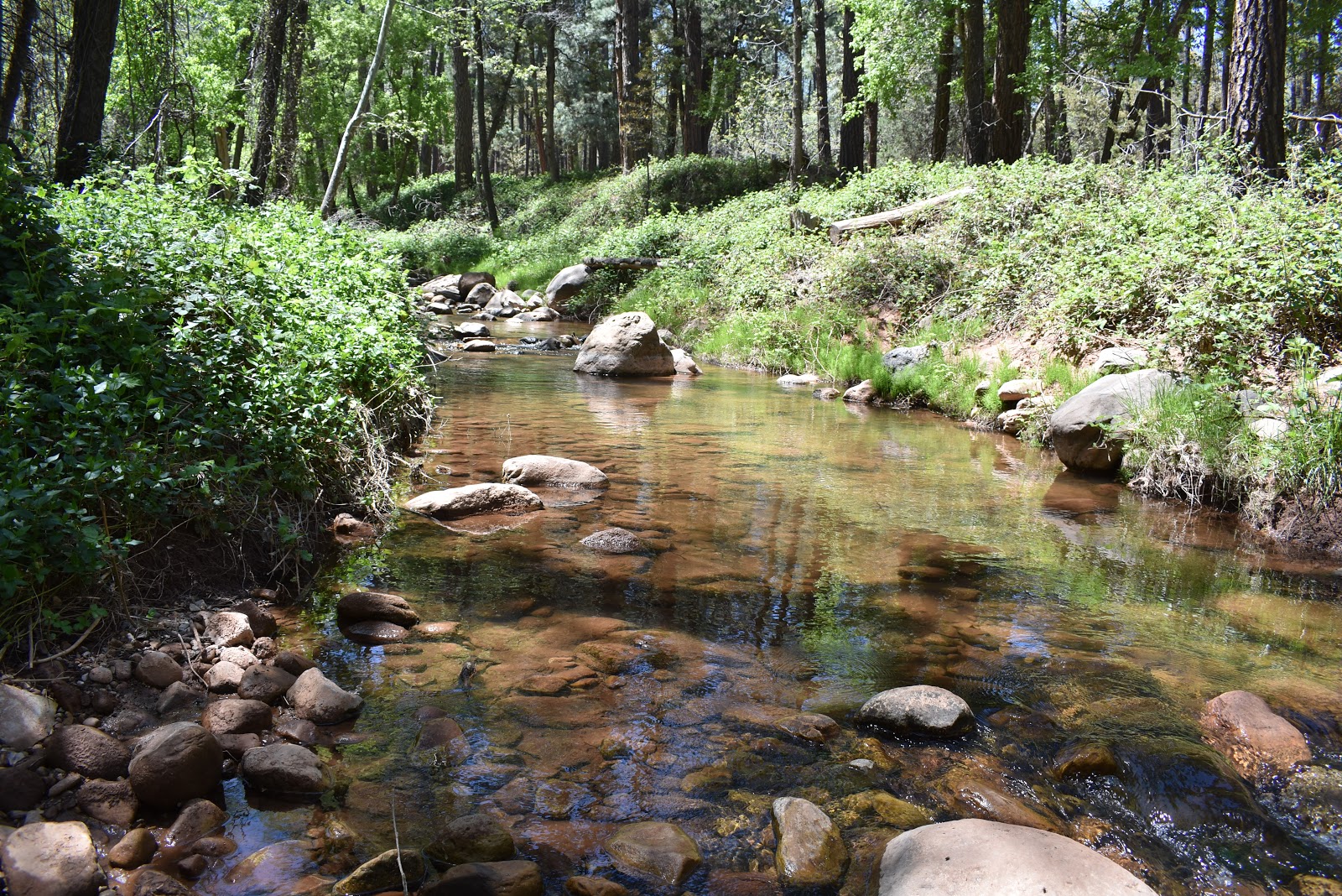
I stopped for lunch near Webber Creek. This area was gorgeous. It had a great, clear, strongly flowing stream. Surrounding the stream were pine trees and the ground was carpeted in lush, green ferns.
 |
| Webber Creek. |
 |
| Lush ferns among the pines. |
Eventually, the AZT joined with the Highline Trail, which I walked most of the rest of the day. This trail used to be a road that connected the settlements below Mogollon Rim. I followed it getting great views of the rim itself as well as crossing streams and occasionally moving through pine forest.
 |
| Mogollon Rim. |
 |
| The Rim from the AZT/Highline Trail. |
As the sun went behind the rim, I made it to Washington Park Trailhead. I moved past it, crossing then following the East Verde River until I found a spot to camp. Tomorrow, I will take that steep climb to the top of the rim.


Comments
Post a Comment