Backpacking Training Trip: Cottonwood Marble Canyon Loop, Death Valley National Park, Day 2
 |
| Cottonwood-Marble Canyon Loop. Day 1: Red, Day 2: Blue. |
Last night was incredibly cold. I can say for sure that is was the coldest night I have ever camped, considering I have never had my water freeze before. And my water was inside my tent!
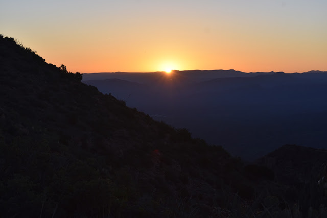
Getting the tent down proved to be quite a challenge. I had only brought a pair of fleece gloves with me for warmth and my bottle of electrolyte drink had spilled on them the night before so now they were useless. I only had my fingerless sun gloves for protection. Knowing that the “tricky part” of the hike was ahead of me today, I wanted to get as early of a start as possible. However, I either accidentally turned my phone off in the dark or the cold was messing with the battery, because, when I woke up, it was past my alarm time and my phone wasn't working. I still managed to wake up and start breaking down camp before the sun broke over the pass I needed to head to.
The inside of my tent's rain fly was completely coated in a fairly thick layer of frost. It is normally orange in color, but at the moment it was practically white. I tried to shake as much of it off as I could, but it wouldn't budge. I ended up just rolling it up anyway knowing that I would have to dry it out at some point. Collapsing the tent poles themselves took much longer than expected since just touching them was rapidly drawing the heat from my hands. I had to pause three times to rewarm my hands in my pockets as they were becoming numb. Eventually I got everything packed up and started for the first pass.
I was fairly confident I knew what the first pass looked like. Again, there may have been an official trail leading to it and there may not have been an official trail. I made an attempt to follow a “trail” for at least half the distance uphill before giving up and just making my own way up it. Once I was at the top I again looked for an official trail, but didn't see anything that looked promising.
I took a minute to survey the topography and it looked like everything from that pass lead down into a single drainage to my right. I headed along the saddle until I found a cairn. I was very thankful for any sign that showed I was going in the right direction.
 |
| The cairn on the saddle of the first pass, looking back in the direction from which I had camped the previous night (west). |
 |
| Looking east from the top of the first pass. |
As I headed down the drainage, everything narrowed down into a single path. When I got to the bottom of that drainage I ran into a thick strand of cottonwoods. From there it looked like there was a path around the cottonwoods and another one leading up a small hill. I decided to take the path up the small hill, if nothing else, to resurvey the area to compare to my topo maps and my cached Google Earth imagery.
To my surprise when I got to the top of the hill I saw two separate tents where people had spent the night. I couldn't help but wonder if it was because it was a good spot to camp or if it was because these people had gotten lost in the area like the hikers I met yesterday.
There were some passes immediately to my left, but I felt like they were too soon to be the pass I need to cross and I didn't want to make the mistake of heading over a pass and down into the wrong area. I had a feeling the pass I was looking for was a little further down. I saw a man packing up one of the tents so I decided to take the trail that skirted around the cottonwoods to where he was to make conversation with him. That way I could find out if he had gotten lost or if he knew which pass was the correct one.
It turns out he did know where the correct pass was. The night before he had scouted out the turn to the pass and found the park service cairn a few feet down from his campsite. It ended up being incredibly fortuitous bumping into him considering he and his wife (who's names were Steve and Heart) had additional navigational resources that I did not have. Steve had a couple of GPS navigational hiking apps on his phone that were able to work in airplane mode. One of them (All Trails) actually had the Cottonwood-Marble Canyon route to follow. Heart pulled out a paper map from the ranger that not only had the route, but detailed descriptions of each section and what to look for. It even had mention of an 8 ft dryfall that you would encounter. I was unaware of the 8 foot dryfall. I was a little mad that I wasn't given a map when I visited the rangers to fill out my voluntary permit. That seems like something pretty important to hand out. It turns out Steve and Heart had the opposite experience with the rangers. They went to fill out a permit but were told they “didn't need one.” They were, however, able to secure that really useful map.
I went over the map details with them and started out on my own since they were still packing up. I ended up finding the cairn that marked the turn to start heading up the pass. I could see how the hikers I met yesterday had missed it. It wasn't very big and there were plenty of other rocks around it. If you looked further up there was another cairn but you pretty much had to be able to see the first one before you could see the second. This was a section that was very easy to blow past.
I turned at the cairns and started heading up the trail. I was pretty confident until I got to a line of stones across the path. I couldn't help but think of my confusion yesterday with the line of stones and the arrow. In that case the line of stones had indicated that it was not the correct path to follow.
Really not wanting to mess up this part of the route, I headed back down the trail to where Steve and Heart would be coming from to see if they would be willing to team up. Thankfully they were! I told them about the line of stones and we started to head up a bit of a wash instead of the beaten path. Apparently, the park service instructions warn you to not follow the footprints in this section, since they tend to not go in the correct direction. I would love to know how many people get lost on this route. It is the most popular route in the park but it seems like a large number of people do not finish.
According to Steve's very helpful app we were slightly off trail but headed in the right direction. When we got to the saddle of the pass, we were able to walk across it to the correct position according to his app. It was right at the end of the trail I thought was the wrong trail. Sorry, Steve and Heart!
On the saddle of the second pass we ran into another issue. There were two “paths” again. One was pretty scary looking and went straight down (and I mean STRAIGHT down). There other one appeared to wind more gently around the saddle to our right. I could practically hear birds chirping looking at that path. Unfortunately we couldn't see if it wound down to where we eventually needed to go.
 |
| Looking down into Dead Horse Canyon from the saddle of the second pass. Not pictured include the steep path that led straight down the gully and the path that followed the saddle to the right. |
After reading over the park map's description several times and consulting the GPS we headed straight down the gully. I'm not going to lie, it made my heart beat pretty fast. It was incredibly steep and loose. At one point I just gave up all dignity and butt-slid down a section where I was pretty sure I would fall anyway. About halfway down Heart and I asked Steve to pull out is phone and recheck that were were on the correct path. I just imagined getting to the bottom and then having to make our way back up again. He checked his GPS and, sure enough, this scary stretch was the official NPS trail.
It took 45 min to get to the bottom of the gully. At the bottom we were officially in Dead Horse Canyon, which should empty out into Marble Canyon. Dead Horse Canyon was narrow, but pretty with some nice camping areas. We checked the next set of instructions and continued on. I was so lucky to bump into Steve and Heart at just the right time on this trip. I was definitely going to stick with them at least until we intersected with Marble Canyon, if they would let me.
 |
| Dead Horse Canyon |
I learned that Steve and Heart were both Pacific Crest Trail veterans from 2012. As if that wasn't awesome enough, they had actually met on the trail. I thought it was pretty fortuitous to bump into them considering I was training for the same trail, but I was reluctant to tell them about it at first. I had finally just let my parents know my plans this week and I didn't necessarily get the reaction I was hoping for. As a result, I didn't have great confidence at the moment. However, when I confided to Heart about my permit, she seemed pretty excited for me.
After filling up with water we continued to head down Dead Horse Canyon. It was pretty easy to follow since we were just following the sand in the direction the spring was flowing. Then we got to an area that looked like a sheer rock drop-off. The three guys we had ran into earlier were skirting around it on the adjacent hillside, but that didn't look right to me. There was loose rock sliding all over the place and there didn't look like there was a good, firm place to put your feet.
We tried it anyway. Steve went first, followed by Heart, then me. It still didn't really look like a path. I was worried that there would be no safe way to get down on the other side. While Steve and Heart scouted it out, my plan was to stay put until I heard that they were sure it was the correct route. However, it got to a point where I couldn't hear their voices very well so I just decided to follow the route that they had taken. Getting down the other side was not easy but Steve was very helpful in getting me down safely.
Looking back at where we had come from, it appeared that the drop off we had seen was actually the 8 ft dryfall we were supposed to somehow scramble down. It looked a lot bigger than 8 ft from the vantage point we originally had on the trail. It also wasn't dry. Technically it was a waterfall. With the added water, I'm not sure which route would have been more dangerous.
 |
| The 8 ft "dryfall" to the left and the scramble path to the right. |
I saw quite a few days hikers in Marble Canyon. It seems more popular than its counterpart for day exploration. The canyon was pretty wide and exposed for a while, but when it narrowed it got really cool and beautiful. It twisted around for a while and then opened up again. I could tell I was getting closer to the entrance where the 4 wheel drive vehicles parked by the amount of gear the day hikers were carrying. I got pretty excited when I saw a couple people carrying only water bottles.
 |
| The gorgeous narrows of Marble Canyon. |


Comments
Post a Comment