Formerly Susanne's PCT Journal. This is a simple trail journal of my long distance thru-hiking adventures/misadventures. Family, friends, and total strangers are welcome to come along for the journey!
-Susanne aka "Snapper"
AZT 2019 Day 6: Forest Road 4026 (mile 92.5) to Cienega Creek (mile 113.0)
Get link
Facebook
X
Pinterest
Email
Other Apps
20.5 miles
It was a super overcast day when I got up this morning. I knew it was supposed to rain at some point, so when I got to the first hill that had cell signal, I checked the forecast. It looked like the main part of the storm was supposed to start around noon and continue through the afternoon.
At the end of the day yesterday, the vegetation had started to change from grasses to cacti, mostly ocotillos. That change continued throughout the morning with other desert and desert-like plants being added including prickly pear cactus, cholla, agave, yuccas, and barrel cactuses.
Ocotillos.
Prickly pear cactus.
As always, there were cows. After about 7 miles, I stopped at a water source called Twin Tanks. It was a cattle tank, but my only guaranteed water source for the next 13 miles. I have filtered water from cow ponds before, and it has been fine, I just try to avoid it at all costs. I filtered some water, and as I finished, a couple of cows came down to get water themselves. They didn't seem happy about having to share.
Cow water.
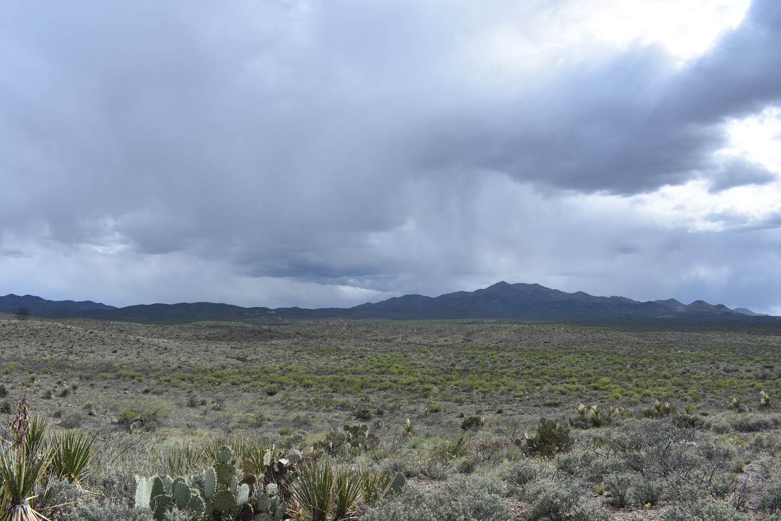
The next part of the trail was full of diverse wildflowers. Unfortunately, not all the flowers were open because it was so overcast. I bet that section looked amazing in the sun. I could see the storm coming, it was hitting the mountains to the north.
Wildflowers on the trail.
Wildflower diversity.
The storm is coming.
Next, I came down in elevation and walked through what looked like a manicured cactus garden, complete with little white flowers filling in the gaps. It was here that I started to see traces of civilization. I was passed by several mountain bikers and a lady walking her dog.
This looks like a garden.
Right?
Finally, I came to a trailhead next to a paved road. I saw a metal box that looked like it could be a trash can. It turned out to be a food storage/resupply box, and it had water in it! I had already walked past several trailheads where trail angels leave water, only to find them empty. This one was fully stocked! I dumped out a liter of filtered cow water and replaced it with cold, drinking water.
I love trail angels!
At this point, I could see the storm to the north and south of me, but it looked like I was benefiting from a split in the storm front. I was preparing all day to get wet, but the storm ended up parting around me. I counted myself lucky.
The storm to the south.
I finished the day by crossing under I-10 and walking past Gabe Zimmerman Trailhead. It was named to honor an aide to Gabrielle Giffords, who was killed in an assassination attempt on Giffords in 2011. She survived, but Zimmerman (an avid hiker) and 5 others died.
The I-10 underpass.
Gabe Zimmerman Trailhead.
I ended the day at Cienega Creek. It had plenty of water, and I even saw a javelina come down to the creek in the evening. Unfortunately, it is right next to the train tracks, with trains screaming through fairly regularly.
20.3 miles Just like the past few mornings, it was difficult to get up again. Unlike the past few mornings, I could actually see snow on top of my tent. It was supposed to rain or snow on and off the majority of the day again. That was not a motivating thought to get me out of my sleeping bag. I had also finally used the hand warmers that I had purchased back in Flagstaff, and they were still warm inside my bag. Somehow, I emerged from that bag and packed everything up one last time. I was only about 20 miles from the Utah border and on schedule to finish the trail today. Most of the items I had on me were damp or wet. It didn’t bother me packing them up as I knew I would be warm and dry tonight. What did bother me was having to put on my wet, cold, dirty shoes. After I did that, I had wet, cold, dirty socks as well. In Flagstaff I had also picked up toe warmers, so I stuck those inside my shoes and hoped that they would help. The view looking out of my tent. My camps...
26.6 FT miles I had meant to get up really early this morning. There were only two places in the St Marks National Wildlife Refuge where you could camp, and there was one that was supposedly one of the best, if not the best, campsite on the trail. However, it was over 26 miles away. Some of those miles were going to be road walks, so those parts would go quickly. On the other hand, if we encountered swampy areas, it might be a very long day. A little before dawn I yelled over at Sugar Rush to see if she was awake, which she was. We packed up in the dark and, just like last night, went crashing through the brush trying to stay on trail. There were some parts that were clear and other parts that were not so clear. When the sun came up, things didn't necessarily get better. We started to realize why we were having so much trouble last night. Even with daylight we couldn't always track the path on the ground and had to search as a team for hidden blazes. The river made...
AZT 2019 Days 34 & 35: Waiting out the weather 0.0 miles Ugh. This was a tough decision, but after experiencing the storm that was accruately predicted (for once), I decided to wait out the rest of the front. The forecast is constantly changing, but yesterday I got soaked on a day when the temperatures never reached 50 degrees F. The truth is that it was the temperature that was the killer. Wet is something you expect on the trail, but you usually have time to dry out and the temperatures are typically warmer. I don't trust the forecast, but if it is as bad as it threatened to be, it makes sense to stay inside, especially since I am walking around an urban area. If I was in the middle of the woods, I would just deal with the misery. It doesn't seem to make sense when I can still hear cars and trains going by. The thing that really sealed the decision is that I will be going up in elevation during the potential storms. The trail goes right underneath the ...


Comments
Post a Comment