AZT 2019 Day 16: Wash road near the Gila River (mile 275.0) to FR4 (mile 292.9)
17.9 miles
It was an early morning. I got up and started hiking before dawn. As usual, I didn't start hiking as early as I would have liked since the ambient temperature has been so pleasant in the dark. It makes hanging out in your tent and playing on your phone much more desirable to hiking.
I needed to get up because I was facing a hot, exposed, 7 mile climb away from the river. Temperatures had been getting warm only a couple hours after the sun came up and I wanted to get as much of the climb done as possible while the temperatures were cool.
 |
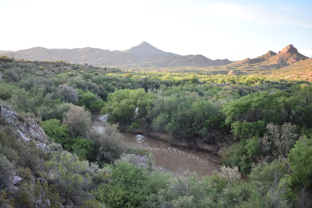
| Morning view of the Gila River from the trail. |
I hit the junction for the beginning of the climb after sunrise, but while it was still cool. It was also the last place to get water for over 11 miles. I still had some water in my pack, but I decided to go down to the Gila and drink a liter of electrolytes.
I hadn't been feeling well during the first part of today's hike. I figured I was dehydrated, low on electrolytes, and low on calories. The heat had been suppressing my appetite. I went the past couple nights without eating dinner. On nights when I did eat dinner I had to force myself to chew and swallow. My normally enjoyable food had no taste, it was like eating paper.
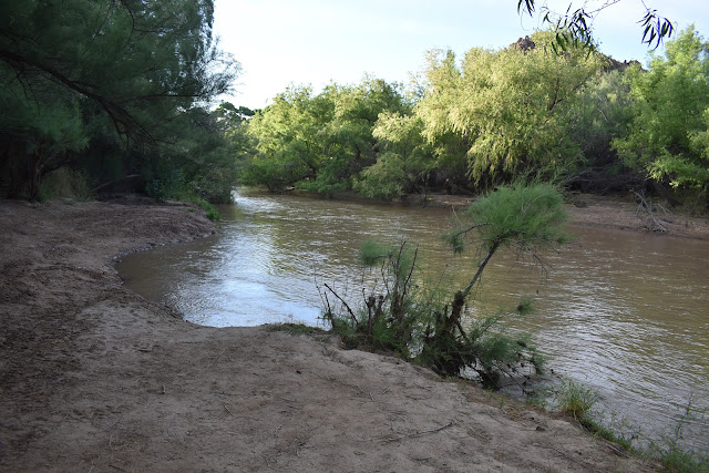
The access point to the Gila River was beautiful and relaxing. It was shaded, had soft sand, a tree to sit on, and rushing water. I could have spent all day there, but I got up early to tackle that climb, not to chill by the river. I ate breakfast, drank my electrolytes, and was photo bombed by cattle as I did my morning video.
 |
| A beautiful breakfast spot. |
Afterwards I slowly and steadily started my climb. It was clear I was headed into new territory. The peaks became more dramatic and there was a lot of striations in the rock. I also saw my 3rd rattlesnake of the hike, who rattled immediately off trail and into the bushes when I approached.
 |
| Starting the climb. |
 |
| New scenery. |
 |
| Saguaros along the trail. |
 |
| Flowers on the trail. |
 |
| Shy rattlesnake. |
The climb was long, but had great views. It had gotten hot by the time I hit the first saddle. I crossed it and headed up and down the next section. I could see the trail most of the way. These mountains were full of deep canyons, and the trail was etched into the side of the mountains, towards the top. It, again, made for amazing views, but was also hot.
 |
| The view after the first climb. |
 |
| The trail next to a deep canyon. |
Next, the trail entered the a basin with a seasonal water source as well as a stock pond. I misread the directions on finding the seasonal water source, going the wrong way in the wash, before deciding to take a well beaten path uphill.
This path lead me to a muddy, algae lined stock pond. I didn't care. It was water and I was almost out of mine. I found the little bit of shade, grabbed some water for electrolytes, and ate a late lunch. I was joined by a swarm of very curious and annoying gnats.
 |
| Water! |
I grabbed two more liters of water to filter, and my filter developed a massive clog. There must have been a large amount of dirt and algae in that water. The second liter was only trickling out of the filter, despite squeezing the bag hard.
As I was packing up, Sierra walked up to get some water. We chatted for a bit and discovered that she was having the same “body problems” because of the heat as I was, including skipping dinner. We were also both going to get picked up by the same trail angel couple, Al and MJ, tomorrow. Since we were only 10 miles from the trailhead, she was going to camp near the pond. It was before 3 PM, and I don't like to camp that early, so I decided to hike on.
The hike was beautiful, I was now descending into lower elevations, so the dramatic peaks and cliffs were rising above me. There were still plenty of wildflowers blooming as well. What there wasn't a lot of was flat, cactus and rock free places to tent.
 |
| View at the start of the descent |
 |
| Wildflowers on the trail. |
 |
| View towards the end of the day. |
I hit an empty water cache at FR4 and looked at the notes left by hikers in the Arizona Trail App. Two people mentioned a camp site here. There wasn't mention of a good campsite for another 5 miles, which would put me closer than I would like to the trailhead I was exiting out of tomorrow.
I decided to camp there. There was a perfect, flat, tent site that was surrounded by the beautiful mountains. It was earlier in the day than I would have liked, but I layed there trying to relax. I even managed to stuff down my normally delicious mac and cheese, despite still not having an appetite.
 |
| My campsite for the night. |
As added entertainment, I got to listen to every hiker/biker who passed by the cache box, open it, close it, then either grumble or curse upon finding it empty.


Comments
Post a Comment