FT2018 Day 31: Campsite on canal embankment (mile 479.6) to Etoniah Creek (mile 502.5)
22.9 FT miles
I started the day off realizing that I had made a mistake. I originally wanted to set up camp just before the canal embankment ended near Buckman Lock. It turns out that the embankment dips down in two places, once to go under a road and once before the lock. Since I camped before the first dip, I still had 2.5 miles before I reached the lock.
I walked the embankment to where it actually ended, then ate breakfast at the adjacent campground. I didn't stay at the campground last night because it had a use fee of $13. The campground consisted solely of a few picnic tables and a chemical toilet. I don't really need a picnic table and didn't want to pay $13 for the privilege of using a chemical toilet.
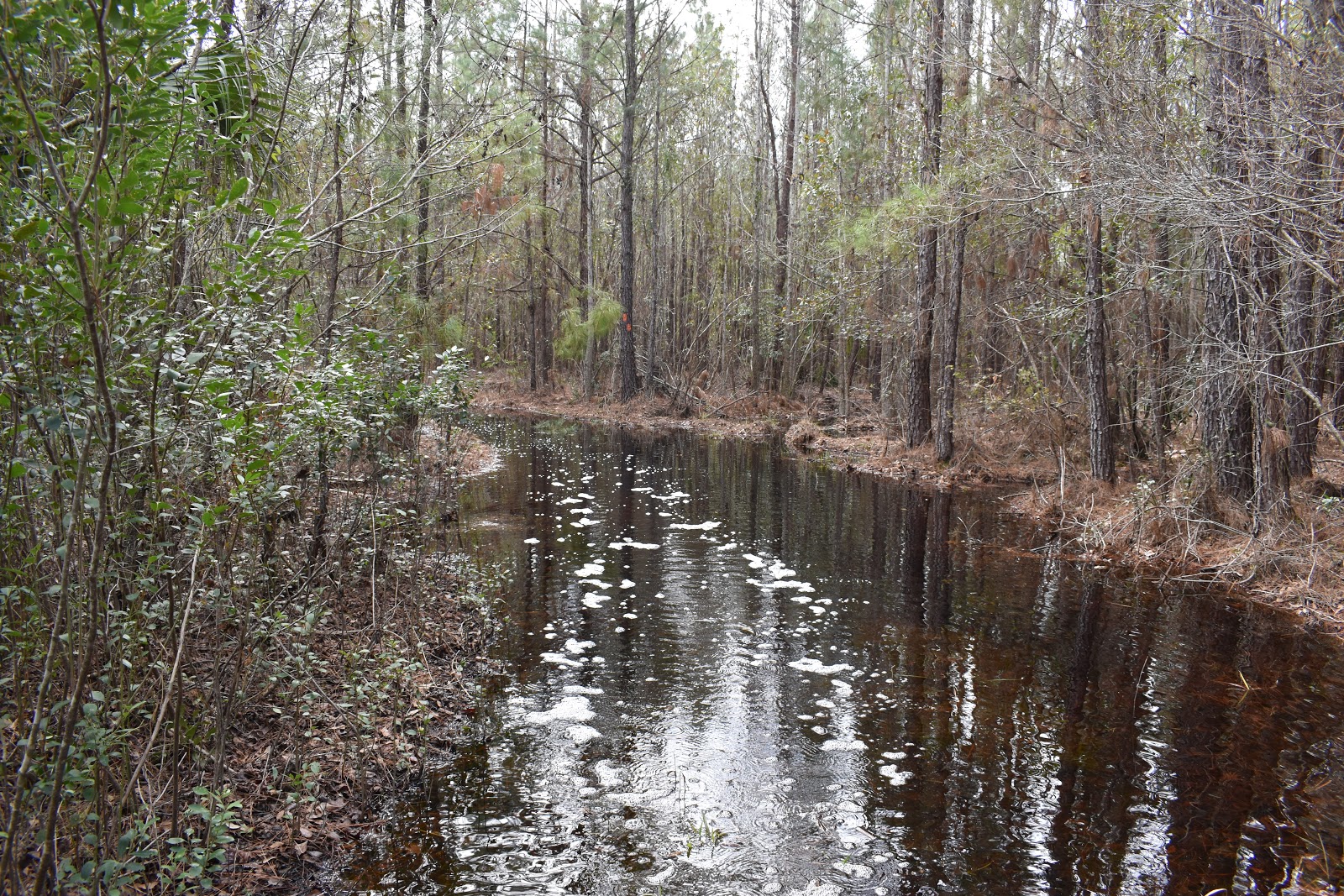
After breakfast, I went to Buckman Lock. I was prepared for the lock experience, since an earlier hiker had posted on Facebook the problem he had with crossing. You had to ring a cowbell to get the lock keeper's attention. If they didn't answer, there was a combination for one of the gate locks written in a special place for FTA members to let themselves through.
 |
| Morning on the canal near Buckman Lock . |
 |
| Buckman Lock . |
I rang the cowbell. There was no answer. I looked for the combination. It wasn't there. Huh? It had to be there. One of the trail coordinators for the area had said that she had personally written it down. I looked, then looked again, and then finally found it. It was so worn and faded that it was barely visible.
I entered the number in the combination lock. The lock didn't open. Maybe there was some kind of trick to opening the lock? It was the kind that you had to depress to open. I pushed it as hard as I could. It did not budge.
Maybe I got the last number wrong? I tried every different combination of the last number. Still, nothing happened. I rang the cowbell again. Nothing. I tried entering the combination again. It didn't work before and it still didn't work now. I rang the cowbell again. Now I was just looking stupid. I went back to fumbling with the lock again.
Finally, the lock keeper noticed me toying with the lock and took pity on me. He came over, opened the gate and escorted me across the lock. While talking to the keeper, I learned that I had indeed gotten the combination wrong. However, it wasn't the last number that was the issue, it was the second number. On my way out he also warned me that the area north of the lock was “wet.”
I then proceeded into this wet area. I had been expecting this as well since a couple of earlier hikers had warned people about this section. The section consisted of a series of logging roads that were partially underwater.
 |
| Logging road. |
 |
| Pond adjacent to the logging roads. |
At first, this was almost amusing. The roads alternated between a flooded pool of water and a short, sandy stretch in rapid succession. The constant in/out/in/out was laughably ridiculous, at least until the pools started to get deep.
 |
| The water course. |
At first I was just kind of plunging straight through the pools. That stopped when I hit the first pool that got knee deep. After that I had to start choosing how I crossed them. For the most part, I would choose the side that appeared the shallowest and would keep as close to the edge as possible. I still got knee deep in some places. Some of the pools had little wooden planks on the side. You know, so you can keep your feet dry.
 |
| Wood plank crossing on the side of the pool. |
I took several breaks during this water course. It was making me tired and hungry. I kept thinking about how spoiled we had gotten in Ocala with its nice, clear, easy trails.
I continued walking and the roads started to dry up the further north I went. I hit what I recognized as an old railroad bed and thought I was in the clear. I started down it, happily observing that I was now on a raised bit of ground and should be dry for a while.
 |
| Drier logging road. |
 |
| Crossing an old railroad trestle . |
Eventually, I checked my GPS to make sure I was still on course. I was not on course. I was way off course. The Florida Trail followed the railroad for only a short time, then cut north to state route 20. I felt like an idiot. As I walked back, I noticed consistent orange blazes on the trees from what must have been an old route. I felt like less of an idiot. The blazes were a bit worn, but they have been pretty worn in certain areas of the trail.
When I got to where I was originally supposed to turn there was an almost comical amount of blazes indicating the turn. I felt like an idiot again. I followed the current trail, doing a little bit of bushwhacking to follow the fresh blazes before joining a flooded road.
I followed flooded roads all the way to SR 20. I was practically wading through a river all the way there. Luckily, the “river" was only about ankle to calf deep, but it was still exhausting work.
 |
| My wake while walking through the flooded trail. |
I was happy to see SR 20. I could see across it, and appeared to be mostly dry, at least for a while. All I had to do was cross one last ditch of water. This ended up being the worst one. The water came up to mid-thigh, even though I crossed the ditch on my tippy-toes.
 |
| The gate for SR 20. Finally! |
Vlog 1
Now extra soggy, I made my way across the 4 lane highway. Once on the other side, I walked until I found shade, then stripped off my socks and had a late lunch. I took my phone off airplane mode and I had a message from a trail angel who had offered to pick up a package in Lake Butler for me, since I wasn't going to get there before the post office closed on Saturday. She needed the tracking number, so I texted my mom and put the phone back in airplane mode since the battery was running low.
I ate lunch, then turned airplane mode off again. I had a text from my mom saying that she was with my grandfather in Minnesota (which I knew) and that she didn't have the tracking number. She said she would have my dad text the number later. The text from my mom that followed that one was one I don't want to see given the sender: Are you OK? That makes me think my mom is worried that I am in trouble. I explained the situation as best I could over text messaging, updated the trail angel, put my phone in airplane mode, and kept moving down the trail.
The road into the next section wasn't too bad, though I still splashed through a few puddles before I bumped into members of a trail crew working on Hoffmann Bridge/Crossing. A little ways down I saw why they were working on it. The crossing was a long catwalk over the swamp and it was broken, twisted, and torn out in places. I was able to navigate it without too much issue, but it was time consuming and I was already behind schedule today.
 |
| Hoffman's Bridge/Crossing . |
 |
| That's a problem. |
 |
| The long catwalk . |
Vlog 2
The rest of Rice Creek was mostly walking through puddles or slippery clay-sand mud. While I appreciated being on a real trail and not a road walk, I was a little worried about losing daylight before I got to an area where I would legally be able to camp for the night. I slowly navigated my way through the area and emerged at SR 100.
 |
| A drier section of Rice Creek. |
Because there was a bridge out on the trail, there was a 3 mile highway detour on SR 100. The worst part of this detour was the very first part where you had to cross a bridge that didn't have much of a shoulder. It had about half a shoulder. The other option was to ford the creek. I took one look at the creek and decided to take the bridge. I found a lull in traffic and ran for it.
The rest of the highway walk was mostly uneventful. My feet, legs, and hips just felt tired. My brain was tired too. I turned onto Caraway Church Rd which was a dirt road that would take me a couple miles to Etoniah Creek, where I could look for a place to camp. As a bit of a welcome relief, the infamous loose dog of Caraway Church Rd did not bother me.
Vlog 3
I slowly dragged myself down the dirt road. The road was made up of some loose sand with the dirt that wasn't always packed down tightly, which just made me more tired. At one point I noticed the glow of my inReach. I checked it and it had somehow managed to factory reset itself, and was telling me to enter an authorization code online in order to function. To make matters worse, it had drained to 30% battery life while waiting for me to choose a language setting. I hoped that wherever I stopped for the night would have cell signal.
It was dark by the time I reached Etoniah Creek. I really needed to stop for the day. I was both physically and mentally tired. I just needed the day to end, so I wasn't too picky about my campsite. I picked the first spot I saw that was a little flat and had the fewest number of sharp plants.
I unpacked my bag and grabbed my tent to set it up. No poles. There were no poles! How could they be missing? My best guess was that I had left them on the ground as I was packing up in the morning. Whatever had happened left me with a hunk of fabric and netting and not my comfortable, familiar sanctuary.
I checked my cell phone. I had no signal. Of course. Ugh. There were no bars at all, just an “x.” I then tried to see if I could force my way through the activation process of my inReach so that I could use it for communication. The inReach was having trouble getting a signal and just draining the battery further.
At this point I was too tired to really be upset or even care. I just needed to close my eyes and wake up to a new day. I decided to just zip myself into that heap of fabric and mesh. It would be better than nothing. At least I had enough energy to think of propping my poles up in an “X" formation. That was able to keep the mesh of my body and my face (just barely).
I didn't even bother with dinner. I just shoved some snacks in my mouth and closed my eyes. The day just needed to be over.


Comments
Post a Comment