14.8 PCT miles
Last night the wind was so loud. I had managed to put my tent in a spot that was pretty sheltered from the wind, but every once in a while there would be a huge gust that would break through the trees I was using as a wind block and rock my world (my warm, enclosed tent space). Needless to say I did not get a good nights sleep.
I also didn't want to break down my tent in the cold wind when I woke up, so I laid in my warm sleeping bag for a while. Eventually I had to get up, since the goal of today was to get through the snow (starting two miles from camp and continuing on for 5 miles) while it was still firm and solid. Of course, after I had packed up and walked a quarter of a mile down the trail, the wind all but disappeared. I'm starting to think that the wind has somehow acquired a twisted sense of humor and enjoys messing with me.
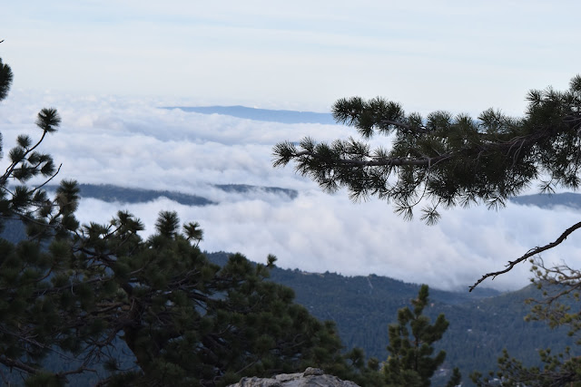 |
| Remnant clouds over Idyllwild. |
As I did the backtrack of shame, first downhill, then uphill, I bumped into two other hikers. That already equaled the total number of hikers that I had seen yesterday. They were brothers, Jameson and John, who were section hiking from Warner Springs to I-10. It would have been nice to have others around me to navigate the snow around the infamous Fuller Ridge, but the brothers were both faster hikers than me and wanted to do a side trip up to San Jacinto Peak. I resigned to the idea that I was probably on my own for the tough stuff on Fuller Ridge again.
When I got to around mile 185, where the snow started, it was so much easier to walk on than yesterday. This area was much more manageable when it was solid. I made it through the section without too much difficulty.
 |
| Heading through the snow again, which was much more manageable in the morning. |
I turned at the sign to Fuller Ridge and, to my surprise, the path was clear of snow. The trail in this section was well constructed, complete with stone steps, and was very beautiful. You could even see the snow covered peak of San Gorgonio through the pine trees. I knew this easy, clear trail wouldn't last for long so I enjoyed it while I could.
 |
| Here it is... |
 |
| I was not expecting this. I will take it. |
Eventually I hit some small snow patches and then a more extensive patch. At this more extensive patch I saw more thru-hikers. This was now over twice as many as I had seen yesterday. There names were Ahab (Sean) and Chelsea, who were travelling together, and Cocoa (Vladimir). I had actually briefly met Cocoa a couple days ago. He was the hiker who finished Fobes Ranch Road with Eleanor and David, but chose to go on and walk the full detour as opposed to hitchhike to Idyllwild.
Apparently none of them had seen many hikers yesterday either because that was the first thing we all commented on after seeing each other. We each thought we were the only idiots out there.
It was really fortuitous that we all met at that location because it was right before a tricky spot on the trail. We had to cross a tributary of the north fork of the San Jacinto River. With the snow melt, the tributary was a spectacular waterfall. It was pretty steep and icy to get to the waterfall, and crossing it was an additional challenge. Not only was there a large of the amount water flowing across the trail, but there were also large, slick granite boulders to navigate. Cocoa went first and was really helpful in getting all the rest of us across. While we were in the process of crossing, the section hiker brothers showed up to cross as well. They had decided against summiting because the trail to the peak was “sketchy.”
 |
| Cocoa approaching the tributary crossing. |
 |
| The tributary cascading over the trail. |
 |
| Chelsea (middle) starting to cross while Cocoa (left) assists Ahab (behind the tree). |
Soon after the tributary crossing, we had to cross a “seasonal stream” that was flooding the trail. If we hadn't gotten our feet wet on the tributary, we definitely got them wet at this crossing. After that, the trail was clear of snow and we all continued at our own individual paces.
 |
| This is clearly the season for the seasonal stream. |
Further down the trail I bumped into the brothers taking a break. They were right at the beginning of a dangerous looking, snow covered section. The trail report I received from the ranger indicated that the following 3 miles would be snow covered. This was the infamous section of the Fuller Ridge Trail. I took a break as well and eventually everyone caught up to each other and we started across it as a group.
The very first part of this section was super sketchy. It was a sharp turn in the trail on an incredibly steep slope. It was covered with a steep snow/ice chute that had a couple of boot prints kicked into the side of it for traction. The good thing about this was that it was only a couple steps, then the snow travel got easier, and after that the trail was clear of snow for a while.
I don't know who designed the trail, but all I could think of while I was walking it was, "This is dumb." The trail would be on a north-facing slope (which receives less light and has more snow), the cross to a south facing slope where it would switchback down, then switchback up again, and cross back over to the north-facing slope. There are easier ways to design a trail that heads down the mountain.
 |
| View of southern California's highest peak, San Gorgonio, in the mountain range across the valley. |
 |
| First views of the desert valley below San Jacinto. |
About 2 miles until the end of the “snow area” from the trail report, the snow kicked in again, but it was not nearly as steep as that first chute we had to traverse. The snow covered section of the trail ended up being long but, for the most part, pretty manageable. The snow was starting to slush by that time of day, so I was siding a little, but I never felt in danger or out of control. A lot of people took an alternate detour to this section to avoid the snow. Those people probably should not attempt the Sierra section of the PCT, especially in such a big snow year. If you did this section at the appropriate time of day, it wasn't bad. It will be way more of a challenge further north in the Sierra.
 |
| Looking back towards the peak from Fuller Ridge. |
 |
| Fuller Ridge. |
After I exited Fuller Ridge, I started walking through Fuller Campground and noticed a bunch of people sitting at a picnic table and joined them for lunch. In addition to the brothers, there was a married thru hiker couple, and another guy with the trail name Detour. Detour had hiked the PCT in past years but today had driven up to the campground and was just hanging out. He had a bag of delicious oranges to share. I finished my lunch and started heading out just as Ahab, Chelsea, and Cocoa came in.
 |
| Just in case the tree didn't tip you off. |
I started down the switchbacks that would eventually take me down to the valley floor. San Jacinto started to get large again as I headed down in elevation and I was getting great views of the valley below as well as the wind farm.
 |
| Heading down the switchbacks with San Gorgonio in the backgrund. |
 |
| Wind farm. |
Around mile 193 I stopped to get water from a stream off trail. The brothers were already there and able to point me in the right direction. As I filled up my water bottles I noticed something crawling on me. My left pant leg was covered in ladybugs. I had sat down in a swarm of them. Oh well, at the least it wasn't ants again.
 |
| There is a lot of luck on that knee. |
After I got water I left the brothers there and continued down the switchbacks. I wanted to get as far down in elevation as I could in order to have a warmer night. I checked my Guthook app and it didn't list any campsites until mile 201, which was a little further than I wanted to walk today, especially after the morning's snow travel. By this time the wind had picked up again and I wasn't looking forward to another windy night.
 |
| Further down in elevation and back into wildflower country. Looking back at San Jacinto. |
 |
| View from the switchback. |
 |
| Getting warmer. |
 |
| And warmer. |
Around mile 197 I stopped to take a rest. I noticed that I was in a flat area with a lot of bushes, so I decided to take the opportunity to pee. I started walking off trail and noticed a pretty obvious tentsite marked with stones. Better yet, it had shrubs protecting it from the wind. I didn't know if the campsites at mile 201 had wind breaks so I decided that this spot was going to be my tentsite for the night.
I set up my tent and heard noises from the trail. It was the brothers. They noticed me camping there and decided to do the same. Later on Chelsea and Ahab showed up and pitched their tent, followed shortly after by Cocoa. The gang was all there. What strated as a fortuitous tentsite discovery turned into a full campground. We ate dinner, watched the colors of the mountain change as the sun set, chatted a bit, then went to bed.
 |
| Sunset reflecting against San Jacinto. |
 |
| Looking northwest toward San Gorgonio at sunset. |


Comments
Post a Comment