Trail Day 11: Remainder of Mountain Fire Detour to Idyllwild
Originally I was going to skip part of the Mountain Fire Detour. I had taken the PCT to the point where it had closed, then come down the mountain. I figured if I picked it up on the other side of the closure, I would have walked all of the PCT that was available to walk. The detour around the closure was mostly on roads anyway. That didn't count.
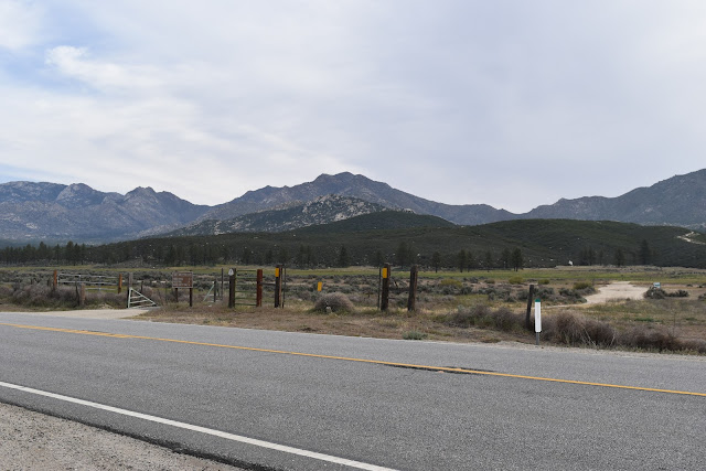
At least that is what I thought as I laid pathetically against the pipe gate at the junction of Fobes Ranch Rd and highway 74. A few days of rest, along with the stupid voices in my head convinced me otherwise. The imaginary PCT "cool kids" in my head were scolding me for not walking the whole thing. After all, the detour was part of the PCT route until the trail could reopen. Additionally, after resting a couple day, walking the remainder of the detour didn't seem like such a bad idea.
 |
| This is where I left off a couple days ago, a sad sack of swollen limbs. |
I had my Trail Angel drop me off where I had gotten a hitch with Elanor and David, and I set off to walk to Idyllwild. A lot of other hikers I had spoken to complained about not wanting to walk on roads, but most of the roads I was on were forest roads. The Forest Service must have a different definition of what a road is because the first road I took looked like two parallel trails. It was actually quite pretty as I was walking through an area with pine trees.
 |
| The Forest Service claims this is a road. |
Eventually, the route spilled back out onto the main highway, highway 74. This was the uncomfortable part of the route. There was no sidewalk so I was walking on the soft sediment on the side of the road. The good thing was that this only happened for a mile and a half. After I passed the Lake Hemet Campground, I crossed the road and entered Hurkey Creek Park where I was able to pick up a trail.
 |
| Highway 74 road walk. |
The trail started uphill, and I felt like I was hiking again, as opposed to being a roadside vagrant. I even stumbled upon a large gopher snake basking on the trail.
 |
| Gopher snake. |
Eventually, I met up with another forest road, this time a wide, unpaved road and continued climbing up towards the town of Idyllwild. There were little lizards running around everywhere. There were lizards I kept seeing, but would disappear before I could whip out my camera. Today I actually got pictures of them. They appear to be whiptails. I had tried to do a crowdsource identification of some of my lizard pictures of the PCT on the PCT 2017 Facebook page, but it turns out almost all the lizards I had been seeing were fence lizards.
 |
| Whiptail. |
I had no idea that fence lizards could darken or lighten their color to help thermoregulate (control body temperature). Therefore, they can look like they have a wide variety of patterns and colors ranging from almost jet black to tan. It was a really cool thing to learn, but I was also disappointing that I was only seeing one species of lizard. Today I got conformation that I was seeing another lizard species.
Eventually I connected with another dirt forest road. These roads seem to be very popular with mountain bikers as I was passed by several. I didn't see a single other hiker.
 |
| Thrashers(?) running on the road. |
 |
| View of a meadow from the detour route. |
 |
| The road to Idyllwild. |
As I climbed further up towards Idyllwild, the pine trees became more dense, the granite boulders started to appear and I got great views of the valley below. In the end I spilled out into the beautiful town Idyllwild's residential section. The houses were huge mountain retreats, so I assumed that residents would be annoyed by dirty, smelly, hiker trash walking through their neighborhoods. To my surprise I saw a welcome sign and water outside one of the more deluxe houses in the area and a lady stopped and offered me a ride to the trail. I politely declined, but it was a very nice gesture.
 |
| A very nice gesture. |
I made it fairy quickly to the trailhead I had wanted to take tomorrow and waited for my ride while admiring the view of the surrounding mountains and watched a little green hummingbird buzz around a manzanita tree.
 |
| The best picture I could get of the hummingbird. |
 |
| Enjoying the view while waiting for my ride. |
My Trail Angel picked me up and I went to stop by the ranger station to check on the mountain conditions. The trail I wanted to take, which would put me on the mountain right at the end of the closure still had a steep, icy section before it connected with the PCT. As a result, I will take a different trail up, backtrack 1.4 miles to the closure and start from there.


Comments
Post a Comment