24.5 PCT miles
The day started early with what seemed like an endless, steep downhill. I was trying to go at a fairly quick pace as today was supposed to be the day the rain and cold front came through. I haven't had cell reception in a while, but if the forecast still held true, the rain would start later in the day.
In a way I was glad for the rain. It would help with the forest fire issues. There still was not much of a view today because of the smoke from the Jolly Mountain Fire and the air still smelled faintly of campfire. I also had to worry about the Diamond Peak Fire north of Stehekin. If that grew any larger it would close the trail in between the last resupply town and Canada. The last road that the PCT crosses has already been shut down to traffic.
When I finally reached the end of the downhill section, and the Wampus River, I ate breakfast and took a break. After that I crossed a series of rivers and creeks. Most of them had at least little waterfalls and clear pools. That has been one of the things that has impressed me about Washington, how clear the water is. I also passed by lots of green vegetation, mostly ferns, but also a plant with some of the biggest leaves I have ever seen.
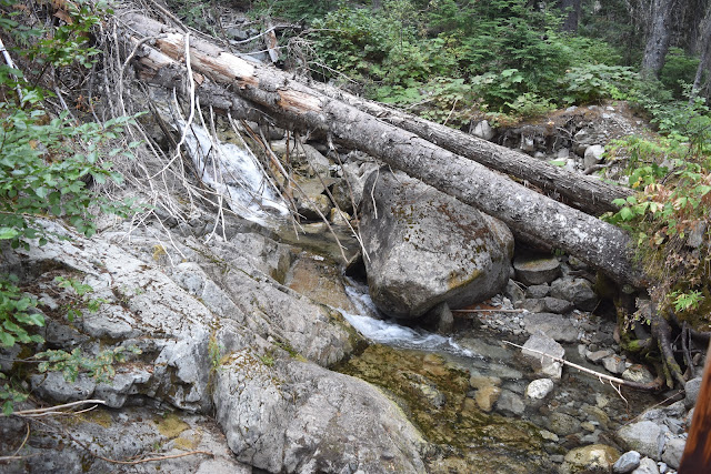 |
| Clear pools ans waterfalls. |
 |
| Another small cascade. |
 |
| I passed numerous closed trails again today. |
 |
| Lush, green vegetation. |
 |
| Gigantic leaves. |
 |
| More clear pools and cascades. |
The next part of the trail was deceptive. It was all uphill, but not so steep that you really took note of it while looking at the elevation profile. Your uphill muscles certainly took note. I became pretty tired as it progressed.
This section had quite a few rivers and streams as well. I took a lunch break at one of them and tried to stretch out my tired muscles. I thought I could feel the wind starting to cool already, so I tried to move out of there as quickly as possible.
 |
| Smoky views. |
 |
| More clear streams. |
 |
| Trail crews helped out with this crossing. |
I listened to my audiobook as I made my way to the top of that extended uphill section and headed down the other side, relieved to get a break from the uphill. I passed some hikers going the other direction and asked if they were ready for the rain. They said that they were glad they got to the top before it started. What did that mean? I had one more downhill section and was hoping to end the day after another uphill section to a pass.
 |
| Smoky meadow. |
 |
| The PCT. |
When I was pretty far down the next downhill section, the rain started. I put on my full rain gear including rain jacket, rain skirt, pack cover, and rain gloves. The rain honestly wasn't too bad, just steady.
I got a little concerned when I got to the bottom of the downhill section. It ended in what was probably (on a clear day) a stunning valley with a really cool cascading stream. The problem was that to get to the stream crossing you had to scramble over what were now wet rocks, then rock hop across other wet rocks to cross the stream itself. I took it very slowly and carefully.
 |
| Rounding into the valley. |
 |
| It is hard to tell from this picture, but the stream's cascade starts all the way at the top. |
As I was heading uphill to Piper Pass, I started leapfrogging with Bam Bam. He said he was headed to Deception Lakes, which was about 2 miles before Piper Pass. I wanted to do as few miles as possible into town tomorrow so I told him I was aiming for the first tentsite after Piper Pass.
I had to book it to get the that campsite before the light faded. I turned my audiobook on again and attacked the hill. I felt another wave of relief after I reached the pass and started heading downhill again. I found the campsite I was looking for and just barely got my tent set up before the last bit of light faded. I had set up just in time. As the last bit of light faded, the rain got heavier and I was glad to be inside my shelter.


I can't get enough of your pictures of the Washington section! So beautiful!
ReplyDelete