Trail Day 107: Mazama Village via Annie Spring Trail (mile 1819.2) to tentsite near dirt road (mile 1845.9)
26.7 PCT miles
I was excited for today. It was Crater Lake day, the day I would finally get to see the famous landmark for which the national park was named. I had been looking forward to this day since I had decided to hike the trail.
I got up before sunrise and packed up my tent. My goal was to get to the Rim Village as close to sunrise as I could. It was a couple miles away, so I wouldn't get there for sunrise itself, but I was hoping it would still be pretty.
I headed down the road and hit Annie Creek Trail, which would reconnect me with the PCT. The trail was very steep and it was surprisingly warm for that hour in the morning, no doubt from the nearby fires.
When I hit the junction for the PCT, I joined it and kept going up. It finally dawned on me that I was going to a crater. To get to a crater rim, you had to go up. I connected with the Rim Trail and continued up until I hit Rim Village.
 |
| The Rim Village. |
I walked past the bathrooms and store to the overlook to see the lake. It wasn't there. It was a wall of white smoke. There was a nice sign, however, that showed me what I was supposed to see.
 |
| What a beautiful view. |
 |
| This is supposed to be an overlook. |
After using the bathrooms in the village, I kept hiking along the Rim Trail. The views did not get better. I couldn't have told you there was a lake there at all. What really surprised me was how many people had driven to the various overlooks and were hanging out at the railings, looking out into nothing.
 |
| The Rim Trail. |
 |
| Another stetch of the Rim Trail. |
I hated every minute of walking the Rim Trail. Without the beautiful views, it was a horrible trail. It was mostly soft sand. I felt like I was walking dunes at times. The trail would go steeply up, then steeply down, then join the road. It was also hot and so smoky that it was irritating my eyes.
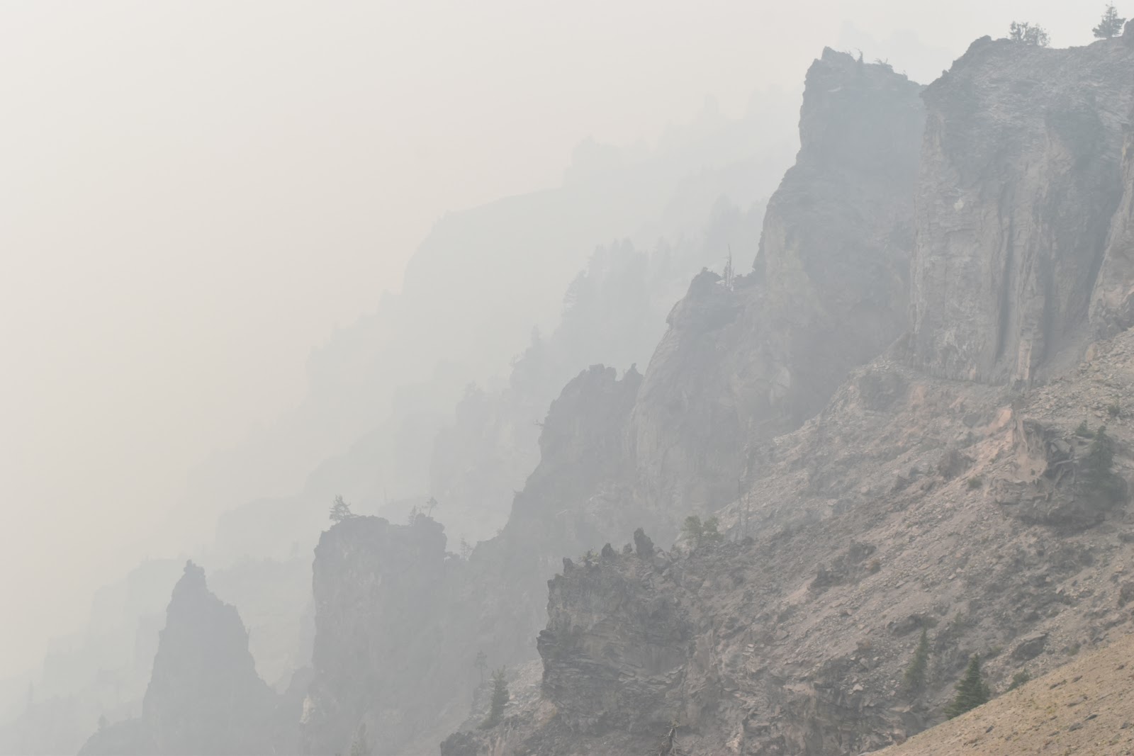 |
| The rim of Crater Lake. |
 |
| The only redeeming part of the Rim Trail was this sighting of yellow-bellied marmots. |
I was relieved when I finally rejoined the PCT. There was a water cache in a bear box just south of the junction. Technically, the junction was the boundary of a trail closure because of one of the fires. I figured it would be OK if I walked down a couple feet.
That is when I heard chainsaws and saw fire response vehicles parked by the road. I assumed it meant the fire crews were “chipping” in that area which meant they probably thought the fire was headed that way. I decided to hold out for the next cache and kept heading north on the PCT.
I also didn't enjoy this section. I was being conservative with my water and it was smoky. I hit a nice section of trees where it was cooler, but then the air got warm again. I was really tired so I stopped to take a break.
 |
| Walking the forest. |
I checked to see if I had cell reception, and I did. I had a couple of text messages come in. One was from Songbeard, asking me about how I got off trail yesterday. Apparently, they expanded the fire closure after I had gone through and the PCT was roped off well before the exit I took.
The second one was from my Trail Angel saying my Shelter Cove resupply box would be arriving Wednesday afternoon. I had planned to be out of Shelter Cove by noon that day at the latest. I was potentially being picked up by an old friend from grad school at the edge of the closureon Thurs., and that would put me behind schedule and possibly require a lot of night hiking.
This really upset me because the last time I communicated with my Trail Angel, I was assured that the package would get there before I did. I was also currently trying to outrace forest fires. As I learned from Songbeard’s text, one day could make a big difference.
I took a longer break than expected. I had been so upset by the text, that I needed to do a mental reset. After that I dragged myself several more miles to a road crossing. There I saw two of my favorite sights on the trail: the PCT symbol and a cooler.
 |
| One of my favorite sights along the PCT. |
Unfortunately, the trail magic had already been raided, but I knew there was a water cache 0.6 miles down the road.
The cache was such a beautiful and welcome sight. I took out my pad and made myself a liter of electrolytes and cooked dinner. I then looked at Guthook to see where the next tentsite was.
 |
| Water! |
Unfortunately, I was in a long stretch without tensites again. I don't think I would have reached the nearest one until at least 10 pm. There was still daylight out, so I had wanted to go further, but I decided to camp right there at the water cache. My body felt exhausted anyway. Since I was near a fire closure, I cowboy camped again with my bag packed in case of emergency.


What a wonderful and amazing journey you've been on. And you've taken some fabulous pictures.
ReplyDeleteYou can see the glow from the smoke in your pictures. Crazy stuff. How has the ash been?
ReplyDeleteThat day I definitely had ash occassionally fluttering down. It certainly was not as bad as the southbounders who described the ash as "rain" from the next fire up the trail.
Delete