17.5 PCT miles
I woke up this morning feeling much better than I had yesterday. Hopefully that means I am starting to adjust both to the hiking and the altitude. Even though I was feeling better, I still got up later than I wanted to.
Eventually, I got moving and headed down the trail. It would go downhill through the pine forest for a couple miles. Occasionally, I would get a glimpse through the trees to the snowy mountains and the grassy meadows. The mountains with snow were already much closer than yesterday, so I should be coming to them soon.
 |
| Morning views. |
I got to the bottom of the downhill section and headed off trail to a creek to refill my water supply. I had considered camping at this location last night, but I just couldn't make it.
I saw a fellow hiker, named Happy, that I had met yesterday. He had camped there the night before and was getting an even later start to the day than I had gotten. He was able to point me to the water but told me there might be “gold” in there.
I walked down to Diaz Creek, which was a fairly large creek. On the bottom of the creek there were shiny flakes of something, but I doubt it was gold. I also thought I saw a fish while I was filling up my filter bag. When I returned to the campsite, Happy confirmed that he saw fish in there too. The previous evening he had seen them jumping out of the water to eat insects.
 |
| This way to Diaz Creek. |
 |
| Diaz Creek. |
 |
| "Gold." |
After refilling my water supply, I started back on the trail which was starting heading back uphill. I was now headed towards Cottonwood Pass and would be doing about 8 miles of uphill. I was not looking forward to that.
I headed up through more pine forest, again getting glimpses of the snow, mountains, and meadows. Eventually I made it up to Mulkey Pass, one of the first bailout points into Horseshoe Meadow below. The trail would rim around Horseshoe Meadow (where you can catch the road to the town of Lone Pine) and I would eventually pass two more exit points into the meadow.
 |
| Going up. |
 |
| View from the trail. |
 |
| Trail junction. |
 |
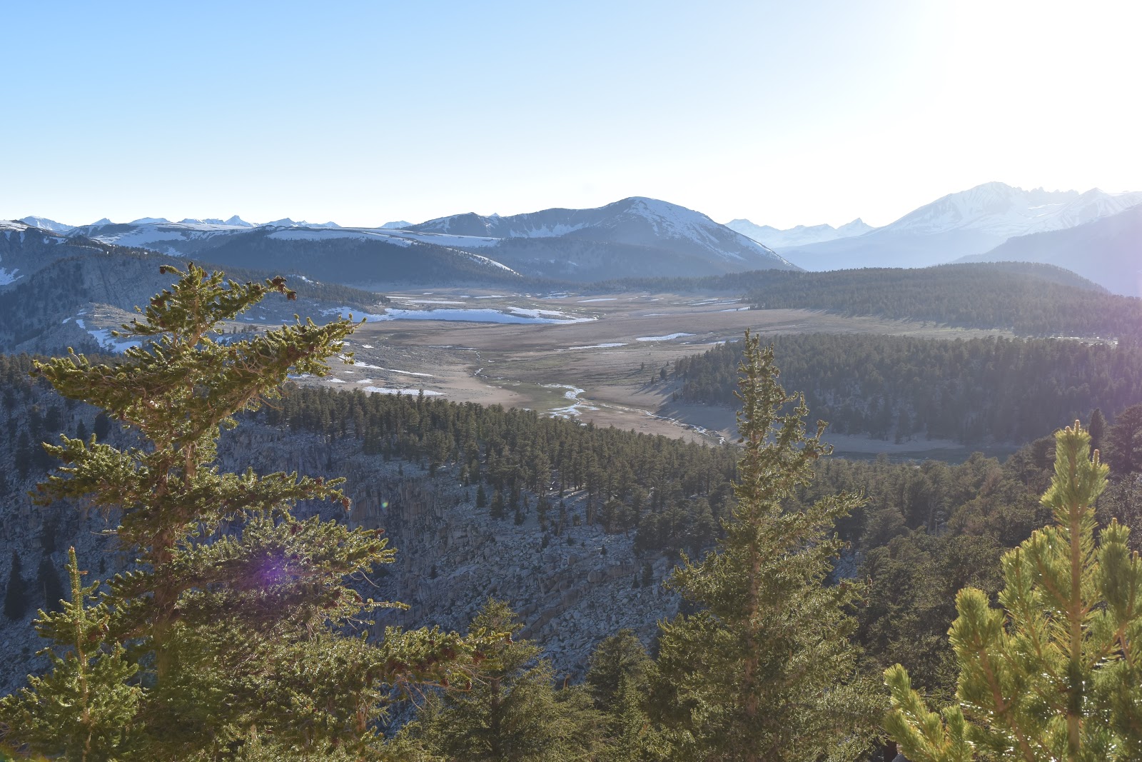
| Horseshoe Meadow. |
The path around Horseshoe Meadow had a couple of seasonal streams that flowed over the trail. There was a lot of water in those seasonal streams. There was a lot of water outside of these seasonal streams as well and the trail was flooded a lot.
I started to see patches of snow near Cottonwood Pass, some of which I had to walk over. Thankfully none of the patches were too extensive.
 |
| High altitude meadow near Cottonwood Pass. |
After Cottonwood Pass I headed for Chicken Spring Lake. I was curious about this spot because it was frozen in all the previous pictures I had seen from hikers this year. It was not frozen anymore. There was still snow on the adjacent mountain as well as some on the trail. There was a small snow bank i had to climb, but that was about the extent of my snow adventure for the day.
 |
| Chicken Spring Lake. |
 |
| Mountain adjacent to Chicken Spring Lake. |
 |
| Snow obstacle. |
After Chicken Spring Lake I continued to get nice views of the surrounding mountains. Eventually I hit a sign designating the border of Sequoia National Park. A few miles after that I found a spot to pitch my tent. It was about as far as my feet and legs were willing to carry me today.
 |
View leaving Chicken Spring Lake.
|
 |
| Entering Sequoia National Park. |


Comments
Post a Comment