Trail Day 63: Soda Springs Campground (mile 911.0) to Marie Lakes Junction (mile 926.9)
15.9 PCT miles
We got a later start than usual leaving the campground, since we weren't going to do a lot of miles today. The goal was to get over Island Pass and set ourselves up for Donohue Pass tomorrow. It was an “easy” day, but the majority of it was uphill, so I was going to struggle.
The trail started to go uphill immediately after we left the campsite, so most of the group got fairly far ahead of me pretty quickly. We were walking through mosquito central, so we all had to keep moving.
After passing another campground and a gorgeous meadow, I reached a trailhead for Agnew Meadow where everyone was taking a break with their mosquito head nets on. Since it was a trailhead, there were pit toilets. They were also unlocked and had toilet paper. What luxury!
 |
| Agnew Meadow. |
After the trailhead we had to go up a set of switchbacks. Usually, this would be my least favorite thing to do. However, there were wildflowers growing all over the place. I really enjoyed stopping to look at and take pictures of the wildflowers.
 |
| Wildflowers on the switchbacks. |
 |
| Cool, orange wilflowers. |
 |
| Pretty, yellow wildflowers. |
 |
| The PCT, a stream, and lupine. |
When the trail stopped switchbacking, it continued up in more of a traverse. We got great views of the snow covered mountains across the way. The PCT and JMT had diverged at this point (but will join back together further down). Those of us on the PCT got to enjoy the views of the mountains from a green traverse. Those hiking the JMT had to go through that snow and it was apparently very difficult.
 |
| The mountain range across the way. |
We rested, then continued up again. One of the more noteworthy things was that we refilled our water supply at a waterfall, then filtered while looking back out at that snowy range. It was one of those moments on the PCT that you can't believe you are really there.
 |
| Sage grabbing water from a waterfall. |
The trail continued up, but also rollercoastered up and down for a while. It was exhausting. We took another break, in which everyone passed out in a power nap, then hiked up again.
 |
| The PCT, heading up. |
 |
| More flowers along the trail. |
That is when we started hitting snow. We had gotten mixed reviews about the snow on Island Pass from the southbound hikers. Some said there was a lot, some said it was patchy. It turned out to have large patches of snow, but a lot of the trail was exposed.
It passed by 1,000 Island Lake which was very beautiful from every angle. Then we hit the pass, which wasn’t as dramatic as the other passes we have crossed. It was very flat at the top and you couldn't really look back to see your ascent, or look forward to see the descent you are about to do. While we were sitting at the top of the pass we got hit with a brief and random hailstorm.
 |
| 1,000 Island Lake. |
 |
| 1,000 Island Lake from a different angle. |
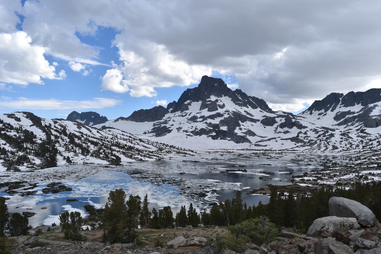 |
| 1,000 Island Lake again (because it is so pretty). |
We descended the pass to where it dipped down in elevation to cross a stream, then headed back uphill again, technically starting our ascent to Donohue Pass.
At this point I felt a drip from my nose. I put my finger up to it and it was blood. Again. I was a little worried about it since I was at no where near as high of an elevation as when I got a nosebleed at Mather Pass. I stuffed toilet paper up my nose and continued up the switchbacks. A little further up, I saw the group waiting. Phoenix saw me and started laughing. She had just gotten a small nose bleed too. It made me feel better to know that it was due to the conditions and not just my body failing me.
We kept going back up until we hit the junction for the Marie Lakes Trail. It was fairly flat at the junction so we were able to set up our tents. We had also just started to encounter patchy snow, so we didn't want to go up too much further.
The junction was next to a raging creek. The trail actually crosses that creek, but that’s something we can figure out how to tackle tomorrow. It might end up being brisk wake up call if we have to ford it somewhere.


The pictures in this post are so amazing! They look like paintings. I actually saved one to my phone for a background.
ReplyDeleteThis was a pretty section.
Delete