Trail Day 16: Tentsite (mile 235.5) to Onyx Summit (mile 252.1)
16.6 PCT miles
Just like yesterday, I was the first one to pack up camp and head out for the day. As I headed up the switchbacks next to the campsite, some of the others were just starting to exit their tents. I took one last look at the hilariously crowded campsite, and tried to get as far uphill as I could before the sun broke over the mountain crests. I remembered how hot it was yesterday and really didn't want to have to deal with that again.
Soon I entered the burn area. I remember watching this fire happen two years ago. Across the valley, I had been taking the Palm Springs Aerial Tramway up to San Jacinto and got a great view of the plumes of smoke rising up just east of San Gorgonio. It was kind of surreal to be walking it today.
The burn area alternated between burned landscape and pockets of unburnt pine forest. The unburnt pine forest area was so nice. I was up around 7,000-8,000 ft, so there was a nice breeze, like something that came out of an air conditioner. The tall pines trees provided shade and the only noises you could hear were the birds chirping. The ground was littered with pine cones and pine needles. The smell was awesome.
The first person I bumped into was a young German woman at my first water source of the day. Her name was Caroline, and I had met her briefly on my fourth trail day. She was part of the "hiker alert network" my Trail Angel activated when he mistakenly missed my "OK message" from SPOT after I had pressed the "Come get me" button in hopes of getting my phone back. She asked me if everything was OK. I had to (again) try to (embarrassingly) explain that it was all a miscommunication, and not an emergency. The "hiker alert network" is a powerful thing. Only Pull Cord In Case Of Emergency.
The trail evened out shortly after that, only dipping down and rising up for short distances. I saw many other thru-hikers today and they were pretty chatty. I saw two of the guys from last night's tent city a few times, a man whose trail name was Salty Dog, and a group whose trail names were Huff'N'Puff, Sticks, and Rosy Petals,
More and more people seem to be acquiring trail names, which are nicknames bestowed upon you by your fellow hikers. I used to be able to ask the story behind the trail name, when only a couple people had them. For instance, Vladimir became known as "Cocoa" when he was making some hot cocoa in the morning. His sleeve caught on a picnic table, and, when he yanked it back, he spilled powdered cocoa all over himself and his electronics bag. Sean became known as "Ahab" because he got impatient on breaks, always wanting to continue on as though he was chasing a white whale. Now, so many people have trail names that I don't even ask anymore. I have a feeling it will be a while before I get one. I take different breaks and rest days than most of the people on the trail. As a result, I have been hiking around a different group of people every couple of days, not long enough to get a nickname.
The trail twisted around the Lake Fire burn area and gave me views of all three of southern California's highest peaks. It wrapped around in close proximity to San Gorgonio, then provided a very faded view of the snow-cap of Mt. Baldy (aka Mt. San Antonio) to the west, and then wrapped around to the desert facing side of the mountain where I saw San Jacinto. I've been looking at that mountain for days!
Eventually I got to a hidden landmark in the mountains, Coons Cabin. It is a San Bernardino Forest use area that features historic cabins. Even better for us thru-hikers, it has both a pit toilet and trash cans. The cabins were pretty cool looking, although they were heavily gratified. This is why we can't have nice things.
I continued through the forest until I reached another PCT oddity. The PCT gets right up to the edge of a "private zoo" just outside Big Bear. Rumor has it that it keeps exotic wildlife for Hollywood productions, but who really knows? The people who run it must have a sense of humor, because the animals visible from the trail were both bears. There was a black bear laying right at the end of its food drop tube and a grizzly bear impatiently pacing back and forth in its pen. The grizzly eventually paused, stood on its hind legs to sniff in my direction, then went back to pacing.
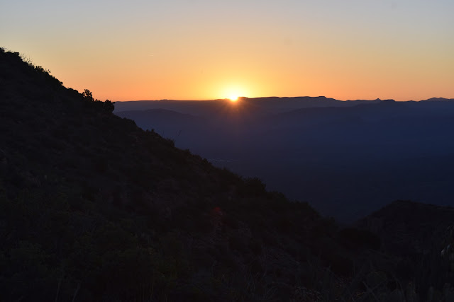
Eventually I got to my pre-arranged pick up spot at Onyx Summit to wait for my Trail Angel. I ended up waiting until almost 8:00 pm, but luckily there was still a bit a light left in the day when he picked me up.
Just like yesterday, I was the first one to pack up camp and head out for the day. As I headed up the switchbacks next to the campsite, some of the others were just starting to exit their tents. I took one last look at the hilariously crowded campsite, and tried to get as far uphill as I could before the sun broke over the mountain crests. I remembered how hot it was yesterday and really didn't want to have to deal with that again.
Soon I entered the burn area. I remember watching this fire happen two years ago. Across the valley, I had been taking the Palm Springs Aerial Tramway up to San Jacinto and got a great view of the plumes of smoke rising up just east of San Gorgonio. It was kind of surreal to be walking it today.
 |
| Blue skies and burnt forest. |
 |
| The edge of the Lake Fire burn area, looking back in the direction in which I came. |
The burn area alternated between burned landscape and pockets of unburnt pine forest. The unburnt pine forest area was so nice. I was up around 7,000-8,000 ft, so there was a nice breeze, like something that came out of an air conditioner. The tall pines trees provided shade and the only noises you could hear were the birds chirping. The ground was littered with pine cones and pine needles. The smell was awesome.
 |
| Lake Fire burn area. |
 |
| Burnt pine forest. |
 |
| Unburnt pines. |
 |
| Pine cones. |
 |
| For your safety. |
The first person I bumped into was a young German woman at my first water source of the day. Her name was Caroline, and I had met her briefly on my fourth trail day. She was part of the "hiker alert network" my Trail Angel activated when he mistakenly missed my "OK message" from SPOT after I had pressed the "Come get me" button in hopes of getting my phone back. She asked me if everything was OK. I had to (again) try to (embarrassingly) explain that it was all a miscommunication, and not an emergency. The "hiker alert network" is a powerful thing. Only Pull Cord In Case Of Emergency.
 |
| Today's water source. |
The trail evened out shortly after that, only dipping down and rising up for short distances. I saw many other thru-hikers today and they were pretty chatty. I saw two of the guys from last night's tent city a few times, a man whose trail name was Salty Dog, and a group whose trail names were Huff'N'Puff, Sticks, and Rosy Petals,
More and more people seem to be acquiring trail names, which are nicknames bestowed upon you by your fellow hikers. I used to be able to ask the story behind the trail name, when only a couple people had them. For instance, Vladimir became known as "Cocoa" when he was making some hot cocoa in the morning. His sleeve caught on a picnic table, and, when he yanked it back, he spilled powdered cocoa all over himself and his electronics bag. Sean became known as "Ahab" because he got impatient on breaks, always wanting to continue on as though he was chasing a white whale. Now, so many people have trail names that I don't even ask anymore. I have a feeling it will be a while before I get one. I take different breaks and rest days than most of the people on the trail. As a result, I have been hiking around a different group of people every couple of days, not long enough to get a nickname.
The trail twisted around the Lake Fire burn area and gave me views of all three of southern California's highest peaks. It wrapped around in close proximity to San Gorgonio, then provided a very faded view of the snow-cap of Mt. Baldy (aka Mt. San Antonio) to the west, and then wrapped around to the desert facing side of the mountain where I saw San Jacinto. I've been looking at that mountain for days!
 |
| Burnt and unburnt patches of pine forest. |
 |
| PCT marker. |
 |
| San Gorgonio. |
 |
| San Jacinto behind the Lake Fire burn area. |
Eventually I got to a hidden landmark in the mountains, Coons Cabin. It is a San Bernardino Forest use area that features historic cabins. Even better for us thru-hikers, it has both a pit toilet and trash cans. The cabins were pretty cool looking, although they were heavily gratified. This is why we can't have nice things.
 |
| Coons Cabin. |
 |
| Inside the main cabin. |
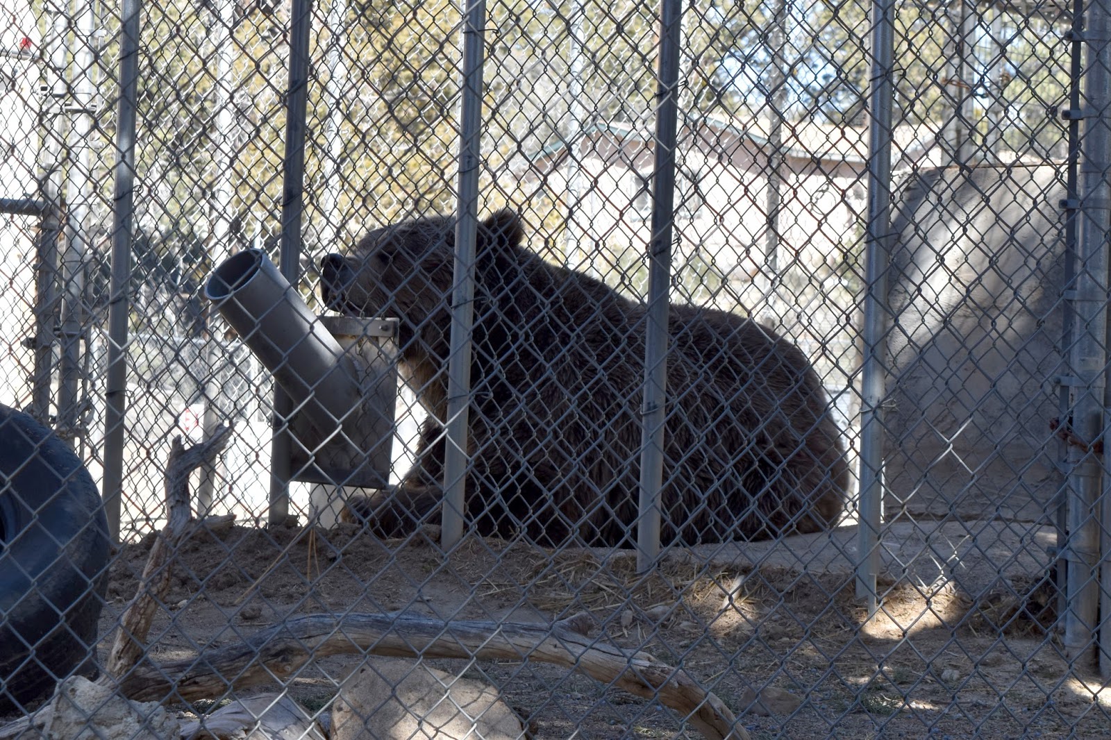
I continued through the forest until I reached another PCT oddity. The PCT gets right up to the edge of a "private zoo" just outside Big Bear. Rumor has it that it keeps exotic wildlife for Hollywood productions, but who really knows? The people who run it must have a sense of humor, because the animals visible from the trail were both bears. There was a black bear laying right at the end of its food drop tube and a grizzly bear impatiently pacing back and forth in its pen. The grizzly eventually paused, stood on its hind legs to sniff in my direction, then went back to pacing.
 |
| Sad black bear. |
 |
| Agitated grizzly bear. |
Eventually I got to my pre-arranged pick up spot at Onyx Summit to wait for my Trail Angel. I ended up waiting until almost 8:00 pm, but luckily there was still a bit a light left in the day when he picked me up.


Comments
Post a Comment