20.0 PCT miles
I was really comfortable when I woke up this morning. The air temperature was nice and cool and I was enjoying my secluded spot way back in the manzanita forest. I knew I had to get up and get going ASAP, though. I had a long day ahead of me and, although it wouldn't be as hot as yesterday, I wanted to get in as much hiking as I could before the heat of the day hit.
I packed up my tent and tiptoed around the heads of the people who were sleeping right in front of the hidden path to my tentsite. When I got to the front of the house I was surprised to see it crowded with people already. I went inside the house and grabbed a plate of pancakes.
As I was coming out I saw Terry on the steps with the bandannas. I missed the bandanna dancing last night, although I heard it from my campsite. That meant I had to do a little shimmy this morning. Terry said, “Show me your moves.” I have no moves. I also had a plate of pancakes in one hand and a fork in the other, so I just spun around a couple times. To spice it up (and add an element of danger), I spun while going down the stairs. Spin-step-spin-step. Terry didn't seem to appreciate the danger aspect of the dance, but she gave me my bandanna anyway.
 |
| Class of 2017 bandanna with the resupply towns and the PCT mile they are located. Also doubles as a sign when hitchiking in/out of towns. |
After breakfast I waited for the morning shuttles to the trail, which would save me two miles of uphill walking. I ended up waiting for a while and getting kind of anxious. We were missing nice, cool hiking weather. I thought about just leaving, but I knew I would be passed by the shuttle if I did that. I managed to get on the first shuttle, which dropped us off at the trail head by 7 am.
 |
| A group picture at Casa de Luna of people leaving on the first shuttle. |
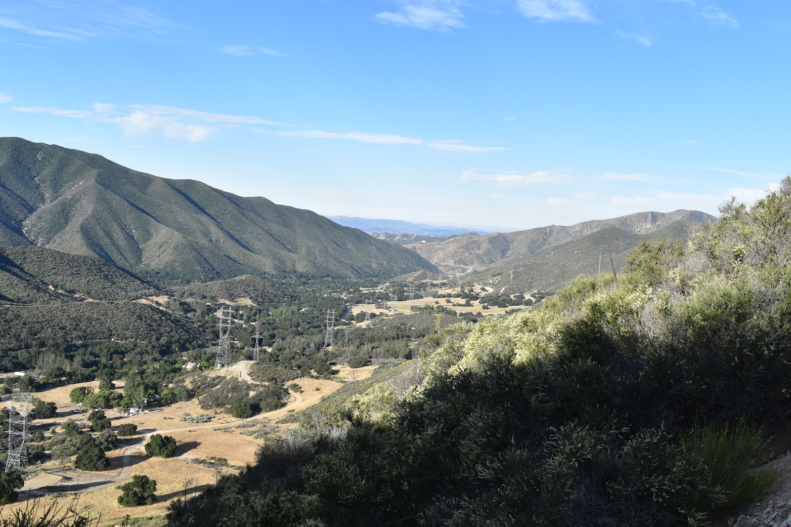
 |
| Looking back at Green Valley as I start to gain in elevation. |
The majority of the day was uphill. I was amazed at how great I felt when I started hiking. My feet didn't hurt, my legs didn't hurt, and I was in a great mood. The scenery was pretty desert shrubs. I breezed by almost 6 miles without even thinking about it.
 |
| The Mojave Desert getting closer. |
 |
| The morning's scenery. |
 |
| Passing a pretty gully. |
When I passed Lake Hughes Road, the climb finally started to get a bit warm again. We were going through another area that had clearly been burned a couple years ago.
After gaining a bit more elevation, I saw a group of people stopped on the path. At first I thought they were just adjusting their packs, but they were actually getting water from a small, seasonal stream. I thought it was pretty miraculous since the water report said the next reliable water source was 15 miles away. The stream was just a light trickle, but someone had made a small basin out of a banana chip bag that made the water collection easier. Thanks, mystery person!
 |
| #unexpectedwatersource and the work of a clever hiker to make collection easier. |
I got to know the group that has stopped for water. There was Linus, Button, and Captain who were all hiking together with matching gear. They had done their trail research together so they had all bought the same gear. Behind them ware Daydream and Waterboy. I had actually sat next to Daydream earlier for the group picture at Casa de Luna. Red Beard, who I had met in the morning also stopped for water.
I drank about a liter of the miracle water (#unexpectedwatersource), then continued the climb up the trail, getting nice views back down San Francisquito Rd., as well as views into the desert I would be crossing later. Eventually, I got a nice view of the wind farm down in the valley. The burn area also had some surprise poodle dog bush, but it was nowhere near the threat that it was in the last burn area.
 |
| Heading through another burn area. |
 |
| The PCT. |
 |
| I'm ba-aack. I have flowers now. Don't I look so innocent? |
 |
| More of the burn area. |
 |
| It is hard to see unless the picture is large, but this is a view of the wind farm in the desert I will eventually walk through. |
When the trail exited the burn area, it got really pretty. I was also up higher in elevation now. The vegetation was much larger and I alternated between walking through shrubs, trees with grasses, and some patches of peaceful pine forest.
 |
| Mountain views. |
 |
| I love these sections that are at higher elevations. |
 |
| I bumped into this sweet looking gopher snake. I terrified the poor thing. |
 |
| I'm enjoying this part of the trail. Soon I will be down in the desert again. |
 |
| Peaceful pine trees! |
My legs and feet were feeling great until the last 4-5 miles. Then I could start to feel the swelling again and my legs were getting tired. I was walking through some incredibly beautiful areas, but I still had to put in my headphones to grind out those last few miles to Sawmill Campground.
 |
| Almost there. |
 |
| Almost, almost there. |
Sawmill Campground is almost exactly half way between Casa de Luna and Hiker Town, so there were a lot of people headed there today. I was worried that the campground would be full and I would have to sleep in close proximity to other people. Luckily, when I got there, people were all huddling their tents around in their own social groups, making little tent cities. That meant that even though there were a lot of people at the campground, I was still able to find a quiet spot to be the noisy, restless sleeper that I am.
The campground also had a water source nearby. I followed the directions in the water report and the Guthook app to get there. It wasn't what I would call nearby. You had to take a forest road up a hill for a ways to get to the cistern. And, I totally love climbing hills at the end of a long day.
The cistern was another interesting experience. It was a concrete tank with a concrete cover. To get to the water, you had to reach through a small opening. When I got there, there were two men, Amir and Roy, helping people get water. There was a small Gatorade bottle attached to a stick to collect water at the cistern, but these guys had cut the top off a gallon jug and were using it to get water. Most of us were filling up several liters so the gallon jug sped that process up. However, it meant that Amir had to lay in the dirt to reach into the cistern with the jug. He volunteered to grab water for everyone who showed up so that no one else had to get dirty. My fellow hikers are awesome.
Eventually, Roy and Amir were going to head down to the campground, so I tried using the Gatorade bottle/stick combo. The Gatorade bottle was attached to the stick like a lure on a fishing pole, so it took a while to get the bottle to sink and fill up with water, and when it finally did, I started to pulling it back. That is when the bottle fell off of the stick! I managed to fish the bottle out of the cistern and Amir came back to redo the knots so that not only was the bottle more secure, but that it was also easier to fill.
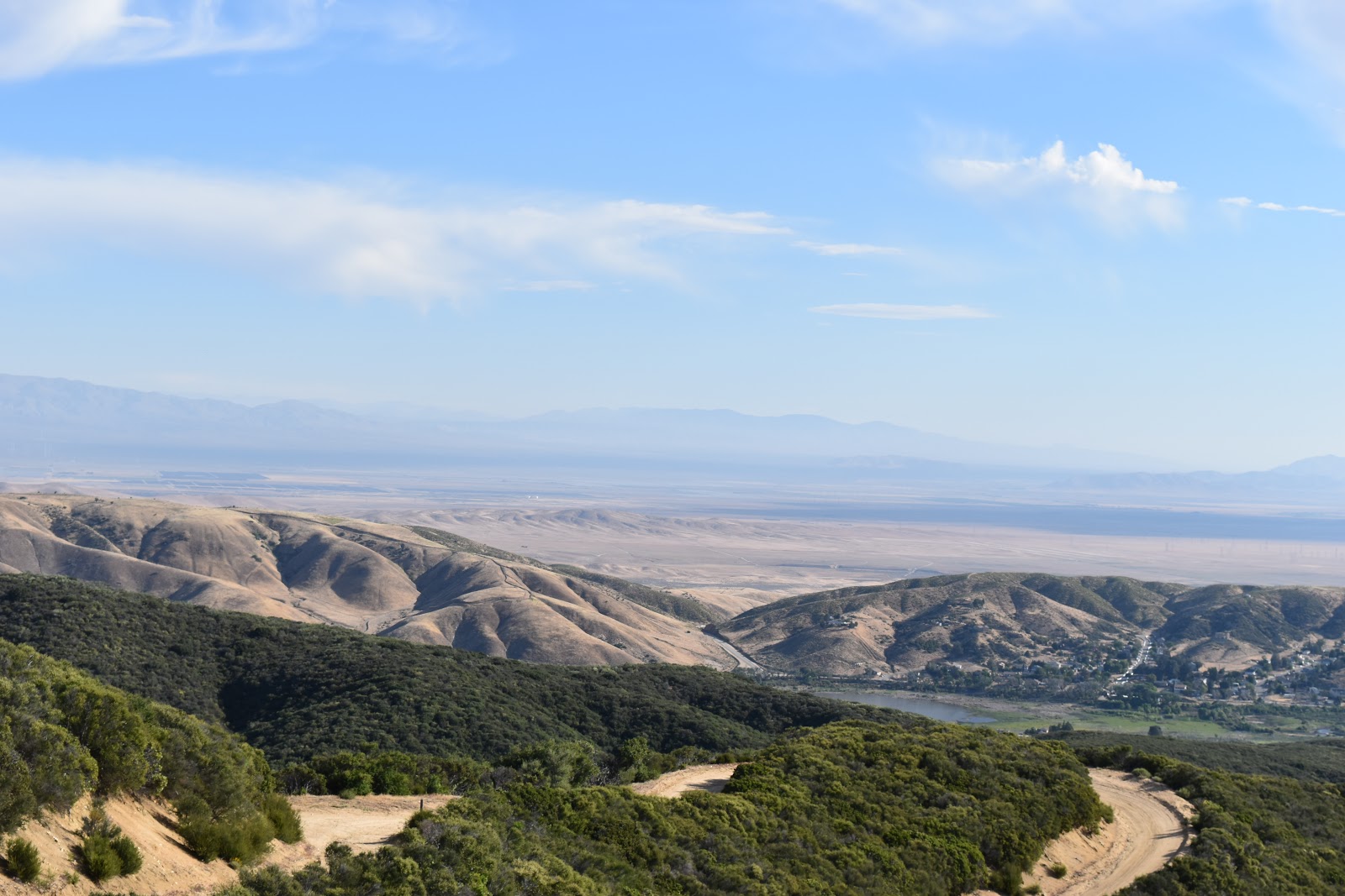
Amir and Roy left (for real this time) so Red Beard, who was also refilling his water at the time, started using the new and improved bottle/stick device. We both managed to refill our water supplies after that. The benefit of the cistern being on top of a hill was that as I was heading down I got great views of the surrounding mountains and the desert below.
 |
| Red Beard successfully using the modified bottle/stick tool. |
 |
| The view coming down from the cistern. |


Comments
Post a Comment