Formerly Susanne's PCT Journal. This is a simple trail journal of my long distance thru-hiking adventures/misadventures. Family, friends, and total strangers are welcome to come along for the journey!
-Susanne aka "Snapper"
Trail Day 29: Acton KOA (mile 444.3) to Agua Dulce (mile 454.5)
Get link
Facebook
X
Pinterest
Email
Other Apps
10.2 PCT miles, plus 1 mile to Hiker Heaven
Last night proved to be a difficult night to sleep. For the most part, I have been camping by myself or pitching my tent a little removed from everyone else because I am a restless sleeper with a noisy air mattress.
This was the first night that I have camped with a large group of people in quite some time. I had wanted to go to bed early last night, so that I could hike before the heat of the day hit today. However, there were a couple groups of people chatting and laughing for a couple hours past when I wanted to go to bed. The KOA also had a pool so a couple people were playing in the pool after dark.
After those fools went to bed, it was my turn to make all the noise with my tossing and turning. All ultralight air mattresses are noisy and make crinkling sounds if you move. The only people who don't make noise at night are those who have foam pads instead of air mattresses. Those pads don't have as much insulation though.
I put on quite a noisy display throughout the night considering I drank at least 3 liters of water when I got to the campground. So, for a while, I was needing to use the bathroom every hour and a half. That meant that when I would get out of my tent during the wee hours of the morning, I would put on a concert of shuffle-crinkle-shuffle-crinkle-shuffle-shuffle-crinkle-crinkle-crinkle-ziiiiiiiiiiiiiiip.
Even though most people were stirring and packing up soon after sunrise, I was one of the first people to leave the campground, albeit on very little sleep. The first thing I had to do was cross the Santa Clara River. In the water notes from past years it was described as a puddle. It was not a puddle this year. Luckily it wasn't too wide and someone had put a board over it to help with crossing.
The Santa Clara River in the early morning.
Next, I had another railroad crossing. Thankfully I had heard the freight train come through about an hour earlier, so I was in the clear when crossing it. Next to the tracks was a monument marking the completion of the PCT. The PCT has been around for a long time, but wasn't fully connected until 1993. The monument marks the final spot that completed the trail.
Railroad crossing in the early morning.
Completion monument.
After the tracks, I started climbing up into the mountains again, which was the main reason behind getting up early. Between Soledad Canyon Rd and Vasquez Rocks were a couple of small desert mountains. Crossing them early in the morning when it was still cool, made for a fairly comfortable experience. Before long, I crossed over a crest and saw highway 14 and Vasquez Rocks below.
Rock formations in the morning light.
Mountains just past Acton.
Looking back at the KOA.
I'm heading towards a location used to film Westerns. Appropriately, I ran into tumbleweed on the trail.
I started heading down the mountains to get to the highway underpass. The lower in elevation I got, the more lush the vegetation became. As I headed towards a nice shaded section of the trail I saw a pink ribbon hanging from a tree. Curiously, I approached it and saw “POISON OAK!” written on it.
I looked up at the leaves, and, yep, that was poison oak hanging over the trail right at head level. I totally would have walked through it had it not been for the ribbon. It seemed like I was in the clear as far as poodle dog bush was concerned, but it looked like I should be paying more attention for poison oak.
Thank you to whoever marked this!
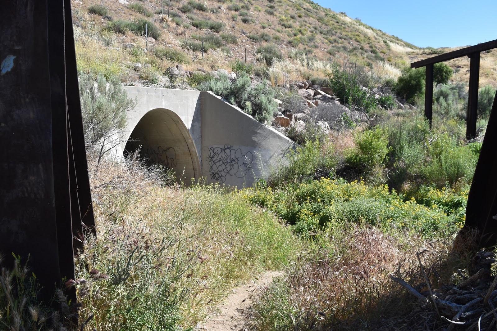
As soon as I passed under the highway, it was like I was transported to a different world. The trail led through amazing rock formations and a pretty little stream full of tadpoles and rimmed with flowers. The famous rocks of the county park were still a mile and a half away.
Highway 14 underpass.
Pacific Crest Trail, Yo Momma.
Sign just past the underpass.
The PCT just past Highway 14.
More PCT scenery.
Tadpoles.
Dragonfly.
Pretty little stream.
More PCT scenery on the way to the county park.
This totally looks like something you would see in a Western.
Rock formations closer to the park.
I had been to the county park before and seen the famous rock formations that appear in countless movies, TV shows, and commercials. However, I had never been that far back in the area, and had no idea that it looked that awesome near the highway. I'm pretty sure some of the first season of Westworld was filmed back in that area in addition to the filming they did by the iconic rocks.
I made my way to the county park and grabbed a picnic table with a great view of the rocks. While I was grabbing a snack, I saw the two guys from central Europe passing by. I tried to express to them how many movies these rocks have appeared in. I think they mostly understood Star Trek and the Flintstones. One of them knew about the show Westworld. Neither of them seemed familiar with Blazing Saddles.
Approaching the famous rocks at the county park from the south.
Vasquez Rocks from the picnic area.
Vasquez Rocks.
Following the PCT around Vasquez Rocks.
A different view while going around Vasquez Rocks.
Looking back at Vasquez Rocks from the north.
I hung out at Vasquez Rocks for a while before heading into the small town of Agua Dulce. The trail officially goes directly through this town, but the "trail" consists of the road's shoulder through this stretch. I always feel awkward, like a vagrant, when this happens.
Walking the road again.
I broke up the walk by stopping at Sweetwater Farms Market, a local grocery store, and loading up on Gatorade, Coca-Cola, and a Toll House cookie ice cream sandwich. As I was enjoying this on a patio table another hiker (Achilles) came by. We started chatting about the trail and our conversation caught the attention of some firefighters sitting at a neighboring table. Since this town is directly on the route, I thought they would be used to hikers, but they had a lot of questions for us about where we were headed, where we started, and how many miles we had done. When we said how many total miles there were on the trail, we were met with a “no thanks.”
I left Achilles and continued to the next intersection. I was making a one mile detour to the famous trail angel house, Hiker Heaven (The Sauffleys). I was being picked up from the trail tonight but I both wanted to experience more of the PCT hospitality, especially after skipping Mike’s Place, and I wanted a comfortable place to wait out the heat of the day.
The road to get there was lined with private properties and I think every property had horses. I was definitely in horse country. When I hit the edge of a property that had both horses and tents set up, I knew I must be at Hiker Heaven.
Typical property on the road to Hiker Heaven.
I walked in and saw a bunch of pop up tents set up. I was greeted by a volunteer who was helping the Sauffleys out. She gave me a briefing of what was at the property. One of the pop up tents had instructions for laundry, including loaner clothes to wear while your clothes were being cleaned. Another pop up tent had a charging station for electronics. The third had boxes in case you needed to mail anything to the towns further down the trail. There was also an outdoor faucet for water.
Pop up tents at Hiker Heaven.
Around the corner was a patio with plenty of comfortable chairs in the shade and music. There was also a double wide trailer with a TV room, a kitchen, and a shower. Next to that was a rack to hang our backpacks, several hiker boxes sorted by type (gear, clothing, food, etc.), and recycling. There was also a large dirt yard area for people to pitch their tents and a line of porta-potties so there was never a bathroom line. The property also had horses, chickens, and dogs running around. This was such an amazing place for thru hikers that do not have the option of going home for these things like I do. It is appropraitely named Hiker Heaven as it has everything a hiker could possibly need. In addition to the main ammenities I listed, they also had smaller things like a mirror/bucket for guys to shave and supplies for a foot soak. These people are called trail “angels” for a reason. I used the bathroom, said "Hi" to the horses, and relaxed on the porch, occasionally chatting with fellow hikers.
Chickens and tents at Hiker Heaven.
Horses at Hiker Heaven.
Eventually my Trail Angel picked me up and we had dinner in town at the Sweetwater Grill before heading home for the weekend.
20.3 miles Just like the past few mornings, it was difficult to get up again. Unlike the past few mornings, I could actually see snow on top of my tent. It was supposed to rain or snow on and off the majority of the day again. That was not a motivating thought to get me out of my sleeping bag. I had also finally used the hand warmers that I had purchased back in Flagstaff, and they were still warm inside my bag. Somehow, I emerged from that bag and packed everything up one last time. I was only about 20 miles from the Utah border and on schedule to finish the trail today. Most of the items I had on me were damp or wet. It didn’t bother me packing them up as I knew I would be warm and dry tonight. What did bother me was having to put on my wet, cold, dirty shoes. After I did that, I had wet, cold, dirty socks as well. In Flagstaff I had also picked up toe warmers, so I stuck those inside my shoes and hoped that they would help. The view looking out of my tent. My camps...
26.6 FT miles I had meant to get up really early this morning. There were only two places in the St Marks National Wildlife Refuge where you could camp, and there was one that was supposedly one of the best, if not the best, campsite on the trail. However, it was over 26 miles away. Some of those miles were going to be road walks, so those parts would go quickly. On the other hand, if we encountered swampy areas, it might be a very long day. A little before dawn I yelled over at Sugar Rush to see if she was awake, which she was. We packed up in the dark and, just like last night, went crashing through the brush trying to stay on trail. There were some parts that were clear and other parts that were not so clear. When the sun came up, things didn't necessarily get better. We started to realize why we were having so much trouble last night. Even with daylight we couldn't always track the path on the ground and had to search as a team for hidden blazes. The river made...
28.4 miles I was another cold, cold morning. The kind that make you have to really convince yourself to get out of your sleeping. And, that is what it did. I talked out loud to myself until I convinced myself to pack everything up. As I was undoing my poles from my tent, one end came loose and whacked me underneath the tip of my nose. It was such a force that I checked for blood. Thankfully, it didn't bleed and wasn't broken. It hurt enough, however, to sit down and take a moment to recover. It was not the start to the day I was looking for. As I headed down the trail, I passed a tank with a deer at the edge, then followed the trail which ran parallel to highway 67. I could see cars going by on their way to and from the Grand Canyon North Rim. Passing a tank in the early morning. Next, the trail climbed up Telephone Hill. Here I encountered an expansive burn area, and I could see storms coming in the distance. Today was supposed to be the first day of a multi day ...


That horse's hair is beyond fabulous!
ReplyDelete