10.0 PCT miles, and 7.5 of detour
It wasn't long after I left my tentsite that I started to encounter snow on the trail. It was fairly patchy and flat at first, with a good set of footprints to walk in, so I did not put my microspikes.
 |
| Sunrise while ascending Mt. Baden-Powell. |
 |
| Sunrise and snow on Mt. Baden-Powell. |
That all changed when I made it further up the switchbacks. The snow got heavier and more irregular. The switchbacks completely disappeared in some sections. The footprints I was following started going straight up the mountain, cutting in between switchbacks, moving from one exposed part of the trail to another. I decided microspikes were a good idea after all. It was still early in the morning and too icy to kick in my own steps.
 |
| The "trail" up Mt. Baden-Powell. |
I followed the footprints until I saw a tent. Whoever made those footprints was still in the tent. I was on my own from there on out. I followed the example of the mysterious footprint person and moved from exposed trail to exposed trail in the most direct manner. Eventually I made it to the spur trail that led to the summit.
 |
| Made it! |
When I got to the top, I had the place all to myself. On clear days you can see the skyline of LA. Today was not a clear day. It was still cool to be at the summit (I have never summited this mountain before) and there was a nice view of Mt. Baldy to the east.
 |
| Mt. Baden-Powell Monument. |
 |
| Me at the monument. |
 |
| Looking east (at Mt. Baldy) from the summit. |
 |
| Looking west from the summit. |
Coming down from Mt. Baden-Powell, the PCT followed a north facing ridge westward for several miles. That meant more patchy snow. A lot of the trail was exposed, but some of it was not. I had to scramble around some of the pockets of snow because the snow didn't evenly coat the ground, it created large snow drifts in areas.
 |
| Stupid, north facing ridge. |
 |
| The PCT runs under this. |
I cleared most of the snow by 10 am (no postholes!) and continued down the ridge getting amazing views of the San Gabriel Mountain Range. I was even more excited to recognize some of it. In addition to the very obvious Mt. Baldy, I saw Mt. Wilson in the distance. I could see a couple of telescopes from the observatory as well as the radio antennas at the peak. Mt. Wilson is a mountain that I have hiked several times, including a training trip I did for the PCT.
 |
| Looking back east from the ridge. |
 |
| Looking west-ish at Mt. Wilson's telescopes (white dots) and antennas. |
Little Jimmy Spring was my first water source for the day. It might be the cutest spring I have seen so far. The spring came out of a pipe and made a mini waterfall into a basin. Surrounding this were several logs cut into a seating area.
 |
| Little Jimmy Spring. |
I met another hiker at the spring and he asked if I was doing the road walk for the detour coming up. We were approaching a section of the PCT that was closed to try to protect the once abundant, now endangered mountain yellow-legged frog (more info at http://www.mylfrog.info). I was confused because according to the Guthook app, the road walk was the route you needed to take. He was also questioning where there would be water, which I also found weird since it is written in the water report.
I went to check the water report and noticed something odd. Some of the distances for the detour water sources were longer distances then the detour itself. When I did a little digging around I found that the road walk is the old detour and that there is a newer, official detour that the Guthook app doesn't have for some reason.
The official detour is about 15 miles longer than the road walk (ouch), but it takes you through the Devil's Punchbowl area, a place I have wanted to see for a while, but have never made it out to see it. Now I have an excuse. Officially.
I headed towards Islip Saddle and studied my paper maps, which had details of the longer, official detour. This was where the official detour split from the PCT, but there was no official sign pointing towards the official detour. I contemplated the trails until I was pretty confident I knew which one was the right one. I had cell signal, so I was able to contact my Trail Angel. The official detour was longer than I was originally expecting, so I needed to come off trail a day early due to a lack of easy pick up locations. I confirmed my new pickup date/location and headed down the trail.
 |
| The trail to Islip Saddle. |
 |
| Highway 2 near Islip Saddle. |
It was going to be a challenge to do this section using only paper maps as opposed to the Guthook app. It is so convenient to press a button and see exactly where you are on the trail, then select something else down trail to see how far away it is. The elevation profile between locations in the app is also extremely helpful.
Since most of the hikers I know are fairly dependent on the Guthook app, I figured I might be the only one headed on the detour today. Therefore I became increasingly paranoid about being on the right trail. Then I remembered that the paper maps were made by Halfmile, who also has an app that I downloaded, so I guessed maybe his app had the official route on it too.
I haven't really been using the Halfmile app. It will find your GPS coordinate and tell you if you are on trail, as well as what mile you are on the trail, but it doesn't show visually where you are on a map, like Guthook does. I opened the Halfmile app and it confirmed that I was on the endangered species detour after all. Thanks for being a bro, Halfmile.
It became clear very quickly that not a lot of people use the official detour trail. Even in washed out sections of the PCT, most of the time there are enough footprints to create a nice solid step. Here, however, much of the trail was washed out and I saw maybe one discernible set of footprints. I had to be careful with my balance and foot placement.
 |
| This is concerning. |
After a while I checked my map. The trail continued like this, following the steep slopes of a gully for four more miles. I put my headphones on to try to stay calm. I was going to be there for a while. I was also going to try not to to blame the poor frogs.
 |
| Ugh. Looks like I am crawling again today. |
 |
| This is a trail? How many more miles of this? |
After several hours, I ended up successfully navigating my way out of the gully, and to the path along the river below. But, by this time my nerves were frazzled and my legs were wobbly from all the extra effort to keep my balance. I knew there was now a road nearby and I was incredibly tempted to call my Trail Angel and pick me up tonight.
 |
| I can see the end of the gully!!! It is such a welcome sight. |
After passing some day hikers, crossing the river (grumble, #unexpectedwatercrossing), I sat down at a campground near the parking lot to calm down and go over my options. The place I had originally wanted to camp was only a little over two miles away and there was still plenty of daylight left to get there. Begrudgingly, I decided to move on.
 |
| South Fork River. |
 |
| Looking back at the gully I just exited. |
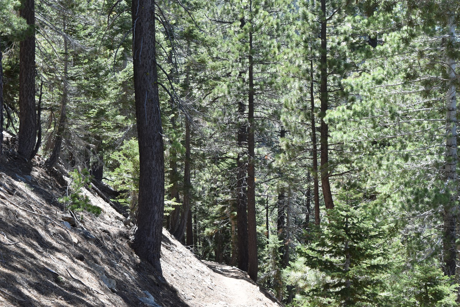
After another water crossing (#anotherunexpectedwatercrossing), I headed down the next trail towards the Devil's Punchbowl area. This trail was a much more pleasant experience. The trail was wide, flat, and well maintained. It was actually a pleasure to walk after what I had just completed. About a mile and a half in it started to get a little washed out again, but I had recovered enough from the rough stuff from before that it didn't affect me as much.
 |
| Another water crossing. |
 |
| Now this is what a trail should look like. |
Eventually the trail came down to an area that was marked with camping on my map. It was very nice. I was glad I continued after all. There was a flat area beneath some trees with log benches. All of this was next to a pretty little creek, complete with waterfalls, where I was able to get water to drink and make dinner. It was a little buggy, but I set up my tent and relaxed inside of it without worrying about being bitten.
 |
| The pretty little creek next to the campsite. |
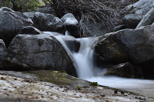 |
| Campsite waterfall. |


Gorgeous waterfall picture!
ReplyDeleteThanks!
Delete